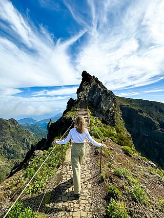


The Andharban Trek in Maharashtra reopened to visitors on August 15, 2026, bringing one of the Sahyadris’ well-known monsoon trails back into operation. The 13-km route begins at Independence Point near Pimpri Village in Tamhini Ghat, at an elevation of around 2,160 feet, and descends through dense forest, streams and seasonal waterfalls before ending at the backwaters of Bhira Dam. The trail also offers views of the Kundalika Valley, Devkund Waterfall, Tamhini Ghat and the surrounding Sahyadri ranges.
The name Andharban comes from two Marathi words: andhar, meaning darkness, and ban, meaning forest. Much of the trail passes beneath a dense forest canopy, which gives the route its name and character. The monsoon is the most popular season for it, when the forest turns green and streams and waterfalls appear along the route. Since entry is regulated, trekkers should check the latest Forest Department guidelines, restrictions and booking requirements before setting out.
Through The Forest To Bhira Dam
The trek begins near Pimpri Village, initially passing through paddy fields before entering the Andharban forest. The route follows a largely defined dirt trail, with occasional ascents and sections that open into grassland. Much of the walk is through dense vegetation, although there are periodic views of the Kundalika Valley and the surrounding hills.


Monsoon conditions change the character of the trail. Streams and rivulets run across parts of the route, while waterfalls and natural ponds can form along the way. Some sections may require additional care when water levels rise. The trail eventually reaches an open grassland area, followed by Hirdi village. From there, the route descends towards Bhira Dam, including sections of large stone steps.
There is also a shorter way to experience the trail. Instead of continuing to Bhira Dam, trekkers can turn back around the large grassland section and return to Pimpri along the same route. This option eliminates the need to arrange separate transport between the start and end points.
How Difficult Is The Andharban Trek?
The Andharban Trek covers approximately 13 km, although the time required varies depending on pace, breaks and weather. Estimates range from four to five hours to six to seven hours. Trekkers should therefore allow most of the day rather than planning around a strict completion time.

The trek is generally described as easy to moderate, but the distance and monsoon conditions require reasonable stamina. The trail involves prolonged walking, muddy sections, slippery stone steps and, depending on rainfall, stream crossings. A basic level of fitness is sufficient for most trekkers, provided they are comfortable walking for several hours.
The trek is not particularly steep throughout, as much of the route initially runs through the forest before descending towards the valley. However, conditions rather than elevation gain can be the greater challenge during the rains. Mud, puddles and flowing water can slow the pace, while rain can make the stone steps near the latter part of the route harder to navigate.
Permits, Registration And Getting There
Andharban is a regulated forest trail, so trekkers need to register online and obtain a forest entry permit before setting out. Advance booking is mandatory through the official Andharban Booking Portal, with no offline or spot bookings. The trail is limited to 700 trekkers a day, and visitors must carry a printed copy of their booking receipt along with a valid government-issued photo ID matching the booking. Trekkers must also be at least 16 years old.
Entry is allowed between 6 AM and 11:30 AM, with all visitors required to exit by 4:30 PM. A trained local guide appointed by the Forest Department is mandatory for all visitors. These timings, along with the daily cap on entries, mean that trekkers planning a monsoon visit should arrange their permit and guide in advance rather than treating the trek as a spontaneous day trip.
The trail itself is defined, but some sections can become difficult during heavy rain, particularly where streams cross the route. The start and endpoint are in different locations. Pimpri Village and Bhira Dam are about 22 km apart by road, and there is limited availability of taxis or shared transport in the area. Mobile network coverage is also limited. This makes transport planning particularly important for those attempting the full route independently.
Andharban is around 70–75 km from central Pune and approximately 130 km from Mumbai. The drive from Pune takes around two to three hours one way and passes through Mulshi, with the route running alongside Mulshi Lake before reaching the trek's starting point. An early departure is advisable for those planning to complete the trek and return to Pune on the same day.

When To Go And What To Carry
The monsoon season, particularly July to September, is considered the best time to see Andharban's waterfalls, streams, dense greenery and mist. October to December offers comparatively clearer mountain views and easier walking conditions, while the landscape remains green.
Rain can also affect whether the trail is open. During periods of heavy showers, the Forest Department may temporarily close the trek until conditions improve. Checking the latest closure notices, entry rules and booking status before leaving is therefore essential.
There are few restaurants, kitchens or food facilities along the trail. Trekkers should carry enough food and water for the entire walk. Recommended supplies include two to three litres of water, energy bars or other trail snacks, full rainwear, a 20–30-litre backpack with a rain cover, trekking or hiking shoes, mosquito repellent and a towel if they plan to use the natural pools. Waterproof footwear is preferable during the monsoon, while long trousers are more practical than shorts in the forest.
For trekkers looking for a monsoon day hike from Pune or Mumbai, Andharban offers a route that changes considerably over its 13 km. The walk begins around cultivated land, moves into dense forest, opens onto grasslands and valley views, passes Hirdi village and eventually descends towards the Bhira Dam backwaters. The route is manageable for reasonably fit trekkers, but monsoon weather, regulated entry, limited transport and the absence of food facilities make preparation an important part of the trek.
FAQs
1. Is the Andharban Trek open in 2026?
Yes. The Andharban Trek reopened on August 15, 2026, for the current season, subject to weather-related closures and Forest Department restrictions.
2. How long is the Andharban Trek?
The full Andharban route is approximately 13 km, from Pimpri Village to the Bhira Dam backwaters.
3. How difficult is the Andharban Trek?
The trek is generally considered easy to moderate. However, monsoon conditions can make the trail more challenging because of mud, slippery sections, flowing water and stone steps.
4. Do I need a permit for the Andharban Trek?
Yes. Entry is regulated and trekkers need to register online and obtain a forest entry permit before visiting.
5. Can I do the Andharban Trek without a guide?
No. A trained local guide appointed by the Forest Department is mandatory for visitors.