Kaurik. A name inscribed on the occasional milestone on the drive up to Shimla, it had fascinated me ever since I was a child. The farthest point on the Hindustan-Tibet Road, Kaurik conjured up mystery and adventure. When I was at school in Chandigarh, a classmate&rsquos father owned oil tankers that went up to the Tibet border. I longed to hop on to one of the tankers and go all the way up to Kaurik. When we finally made it there, Kaurik took us completely by surprise. The trip also found us in Sangla, which could have been the inspiration for James Hilton&rsquos Shangri-la Kalpa, where you feel you can reach out and touch the Kinner Kailash and Spiti.
The drive from Kalka to Shimla, in early May, was probably prettier than at any other time. Brilliant purple jacarandas vied for attention with the wild roses, flowering silver oaks, laburnums and gulmohars. Every now and then a particularly riotous flame of the forest, a burst of scarlet in a sea of green, took our breath away. As we approached Shimla, sections of the road were lined with bottlebrush, also in flower.
Beyond Shimla and Narkanda, NH22 goes along the Sutlej. We crossed the Wangtu Bridge, the spot where travellers and traders have crossed the Sutlej from time immemorial, and drove to Karchham from where we turned off NH22 to Sangla. The 18km drive from Karchham to Sangla is not for the faint-hearted. For the most part it is like a ledge, with a sheer drop to the Baspa river below.
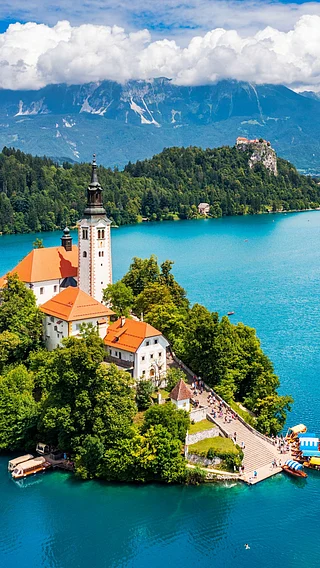
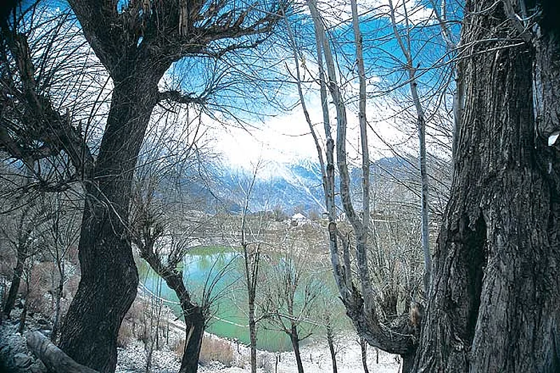
My idea of an idyllic spot is being surrounded by snowcapped mountains, the smell of wood smoke, the sound of a mountain stream, the fragrance of pine, the taste of lightly sautéed trout, and a glass of Chablis. If you carry your own Chablis, Sangla (2,450m above sea level) has the other ingredients.
Sangla is a charming town, fortunately not overrun by tourists. The valley is partly forested, partly cultivated and has many meadows. The river has trout but anglers must be ready to undertake a strenuous trek of an hour to get to the fisheries office to obtain a licence. Our catch was scanty. I think it was a bit early in the year, and the water was too cold. The HPSEB Guesthouse, which we had booked, was a pleasant surprise. Almost palatial, it has a garden where you can have your morning tea and gaze at the snowcapped peaks.
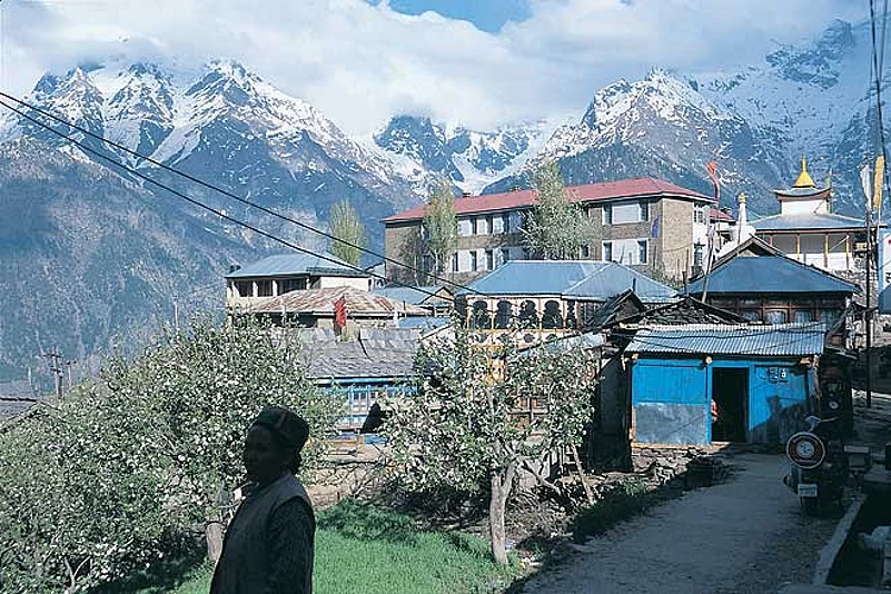
Our next stop was quaint and picturesque Kalpa. Also known as Chini Gaon, Kalpa (2,740m) used to be the district headquarters of Kinnaur before the capital shifted to Rekong Peo, seven kilometres away. From the garden of the brand new PWD Resthouse (which, by the way, is better than the Circuit House next door) you get a spectacular 180-degree view, framed by the pines, of the Kinner Kailash massif. The pine forest slopes down to the river valley and then rises on the other side to the snowline. Along the ridgeline was the famous 72-foot pillar-like monolith known as the Shivaling. Through our binoculars we could see that intrepid devotees had left flags and offerings at its base.
Six kilometres from Kalpa, we came to the end of the road and the village of Roghi. Breathtaking views of the massif and villages in alpine meadows surrounded by thick deodar forests made us stop every few hundred metres. The drop to the Sutlej below was so steep at one point, that one member of our group could not bring himself to stand and look over the edge. He lay down on his stomach and crept up to the edge and peered down. If you do decide to go till the end of this road, park your car before entering Roghi. Turning around later on the narrow path can be hair-raising, we discovered. The whole area around Kalpa has beautiful walks, picturesque villages and lovely people who have the time to talk to you. Apple trees are in blossom, God&rsquos in his heaven, and all seems right with the world.
From Kalpa we headed to Pooh, the Brigade Headquarters of the 36 Sector, also known as Sugar Sector in army lingo. The landscape began to change. Coniferous forests gave way to shrub land. En route from Pooh to Spiti we made a detour and went part of the way towards the Shipki-la pass, the his- toric gateway to Tibet. Another detour took us to Nako Lake.
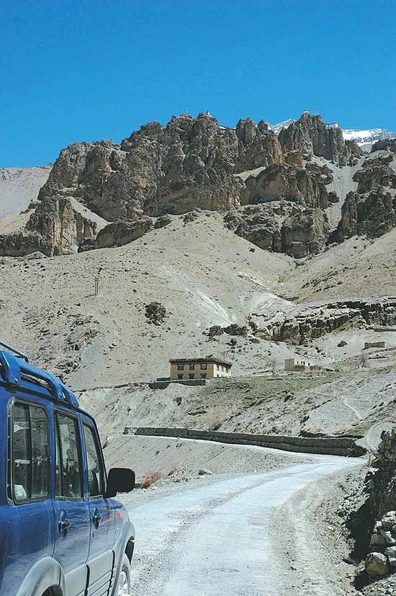
From Nako we headed towards Sumdo, a spectacular drive along the perennially muddy Sutlej, through deep gorges and over bridges spanning glacial streams. We were dreading the approach of Malling though, the location of regular landslides. At Malling the mountain slides 24 hours a day, seven days a week, 365 days a year. Bulldozers clear the road every morning so vehicles can pass. At night the road disappears. We had been told that Malling was now open after being closed for many months. We arrived at 4 o&rsquoclock, an hour after they stop the dozers. Thanks to our army escort, they got the dozers going and cleared the road for us. Crossing Malling is tricky. The earth is loose there is water oozing from the mountain. Your car slides all over while the tyres try to grip the road. Our 4x4 Scorpio got us through without a murmur.
Sumdo lies beyond the confluence of the Sutlej and Spiti rivers, and is the gateway to Spiti. The 89th Armoured Regiment is headquartered here. We were billeted in their mess, on the banks of the Parechu. The Parechu, which would otherwise just be another tributary of the Spiti, has been in the news. This is the river which has a landslide dam upstream in China, the one they expect will burst one day and cause flash floods all the way down to Rampur Bushair. Sumdo was our base for exploring Spiti and Kaurik, the end of the road.
From Sumdo, the drive to Tabo was through a narrow gorge along the Spiti river. From Tabo, the valley started to open up. The brown, ochre and dun slopes on the two sides became gentler. Steep, craggy cliffs and ridges gave way to sensuously rounded mountains, with picturesque villages and monasteries. The mountaintops, in early May, were still blanketed with last winter&rsquos snow. As the valley opened up, the Spiti river slowed down, sometimes becoming just a braided stream, several hundred metres wide. From Kaza, the district headquarters of Lahaul and Spiti, the road seemed to disappear into the high snow-covered mountains. And we seemed to have reached the end of the world.
A few kilometres beyond Kaza, perched above the valley, was the famous Ki Monastery. Ki has a collection of palm leaf sutras, some 400-600 years old. We were shown around the secret rooms in which treasures used to be hidden when the monastery was under attack. The view from the top of the monastery was worth several rolls of film. Below the monastery was Ki village, and below the village were fields being readied for the single crop that would be raised before the land froze again. Across the one-kilometre wide valley, through which the Spiti lazily crawls, were mountains topped by pure white snow. Irrespective of where you go in India, the smallest village or the highest monastery, you cannot get away from cricket. I have seen cricket being played at Alchi, and now saw it at Ki, 4,115m above sea level. The players were none other than the acolytes. I guess pursuit of spirituality does not exclude love of cricket.
And finally we were on our way to Kaurik, the mysterious place that had brought us all the way to Spiti. The road going to Kaurik from Sumdo took us to Sugar Point, 3,740m above sea level. This is the staging point for stocking the pickets along the Line of Actual Control (LAC) on the Indo-Tibetan border. The road ended at Sugar Point. There was no road to Kaurik. For the simple reason that there was no Kaurik&mdashit had been destroyed by a massive landslide some 25-30 years ago. All that was left was a handful of crumbling mud structures. You cannot drive to the ruins, even though Kaurik continues to be mentioned on scores of milestones on NH22. An hour&rsquos walk took us to what was left of Kaurik. It reminded me of the deserted Mexican villages one sees in Clint Eastwood movies. Dry, dusty, haunted, with the occasional shaft of light through a broken doorway heightening the silence and eeriness.
But the journey to Kaurik brought other rewards. Another hour&rsquos walk beyond Kaurik was Lepcha, literally the last Indian picket on the LAC. Standing on the ridge that forms part of the LAC we had a spectacular view of Chinese villages in the valley along the Parechu. Land was being farmed, yaks were grazing. Some tents had been erected higher up on the hillside, apparently to evacuate people in case of flash floods in the Parechu. As we stood on the LAC, we wondered if someone down there in China was looking at us and remarking about the unusual flurry of activity today. We crossed over the LAC, unchallenged, expecting a warning shot to ring out. None did. Did I say sadly Because that would have been the most unexpected event in a journey that defied all expectation.
The information
The route There are two ways of getting to Spiti. One is over the Rohtang Pass, via Manali, and then through Lahaul over Kunzum-la. But that is possible only after the two passes open, usually in June (till September). The other route takes you on NH22 via Shimla, Rampur Bushair and Pooh. In early May, NH22 is the only way, provided you can get through Malling. Our route was Delhi-Shimla-Narkanda-RampurBushair-Karchham-Sangla-Karchham-Pooh-Sumdo-Tabo-Kaza.
Where to stay
&mdashNarkanda After a leisurely 12-hour drive (we took several breaks for tea and meals), Narkanda was our first overnight halt. We stayed at Himachal Tourism&rsquos Hotel Hatu (01782-242430). There&rsquos also a new resort option, Narkanda Camps and Resorts (242641).
&mdashSangla Another 6-7 hours of driving to our next stop. We stayed at the local State Electricity Board Guesthouse but there are a few options to choose from in Sangla now. At the top end is the tented camp run by Banjara Camps (01786-242536, 011-26861397 www.banjaracamps.com). The other options are Mount Kailash Guesthouse (242527).
&mdashKalpa We stayed at the excellent PWD Guesthouse here. For bookings call the Kinnaur office at 01786-222227. There is also the Kinner Villa in Kalpa (226012).
&mdashSumdo We stayed as guests courtesy a friend in the Indian Army, but Banjara has camps in Kaza and Tabo nearby.
Travel tips
&mdashThere is no petrol pump for a long stretch between Rekong Peo and Kaza and it&rsquos best to carry a jerry of fuel with you in case of road emergencies.
&mdashEven though you&rsquore driving and gradually acclimatising to the high altitudes, it&rsquos best to take the usual precautions&mdashavoid over-exertion and drink lots of fluids&mdashto avoid falling ill.
&mdashThe difference between day and night temperatures can be extreme. Dress appropriately. It&rsquos also very windy and dry so carry sunscreen and lotions with you.
&mdashAll of Sangla is a great area for fishing, especially between August and September.