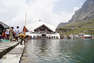
We had just arrived at the eerie village of Bhyundar after a week-long trek in the picturesque Valley of Flowers and Hemkund in Uttarakhand on a September evening. With a group of five intrepid trekkers, I was eager and looking forward to yet another adventurous trek, Kagbhusandi Tal, a less-trodden trail in the region.
The central Himalayan belt is known for exotic high-altitude lakes. Some lesser-known ones are tucked away in remote corners, thus making it necessary for one to traverse great distances just to get a glimpse.
There were some risks involved but we decided to do the trek anyway. We were cautioned by locals about the terrain, streams, broken glaciers, crossing boulders and high passes in unfavourable weather conditions. But, our only concern was getting a guide who had a good sense of direction, someone who could steer us through a not-so-well-marked topography devastated by the previous years flood. (Since then, the Forest department was hesitant to grant a permit to the remote lake as the trail had been washed away)
We finally succeeded in finding our guide, Raman Singh Negi, and few porters from Joshimath, for the trek.
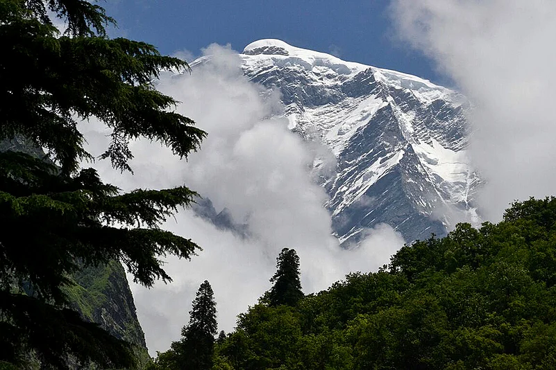
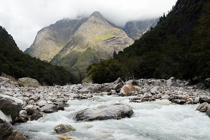
However, the weather reports cautioned of rainfall and dark clouds. A glimpse of the peak of Hathi Parbat (6727 m) in the morning over the tree line in the valley fired our spirits. Taking a diversion from Bhyundar, we crossed Laxman Ganga over a makeshift bridge. Then we took the trail going to the right, along Karnkul Ganga. As forewarned, the trail had been washed away.
After walking for six hours through the valley we reached our campsite, an undulating alpine meadow called Samartoli.
The next day the skies were clear, displaying the mountains looming in the distance. A quick breakfast later, we began our journey. The valley after Samartoli widened and was rocky and flat. From a distance, we could see the denuded ridges of the Dang Kharak glacier. Crossing the stream below the snout of glacial moraine and after a steep climb over scree, we reached the vast slope of Dang Kharak.
By the time we reached it was late and it was starting to snow. Next morning the whole chain of snow clad peaks encircling the valley was glowing in the sunrise. It was a tough day as we crossed Kankul Khal to reach our destination. From the campsite, a little depression was visible due south over a bounding ridge-line. That was the first view of the khal.
Thankfully the skies remained clear. In high spirits, the team set out. The trail to Kankul khal was confusing. Unlike other high altitude passes that I had done, it was difficult to gauge the pass.
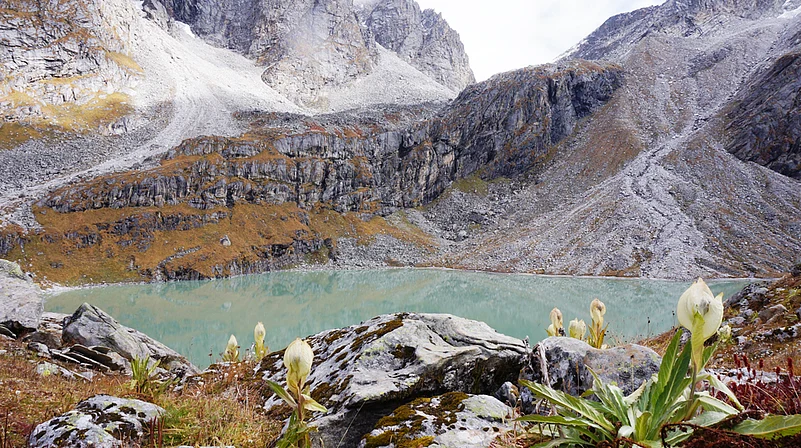
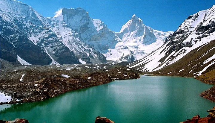
To my dismay the descent was still not identifiable and boulders were slippery due to snowfall. We were greeted by Phen Kamal flowers (Saussurea simpsoniana) on the slopes. After boulder-hopping we reached a point where one could see the hidden emerald jewel—Kagbhusandi Tal.
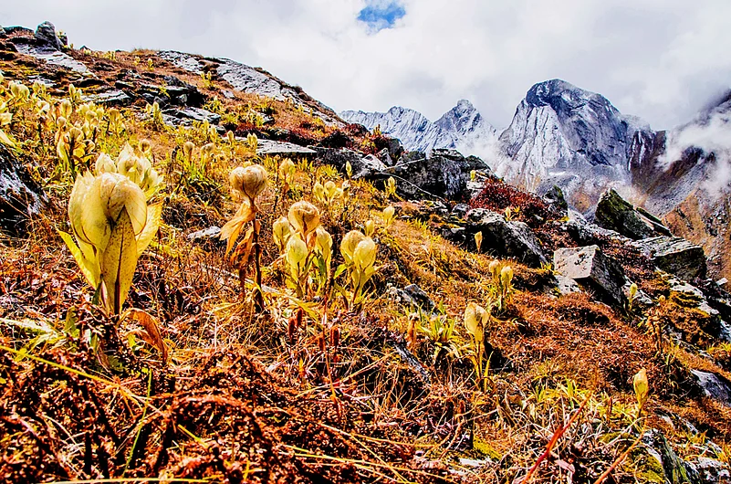
The porters had gone ahead, and soon the tents were visible from the distance, above the cliff overlooking lake. All we needed was water and the warmth of a sleeping bag. To make the lake more enchanting, the Brahma Kamal flowers (Saussurea Obvallatta) were in bloom.
There are mythological stories associated with the Tal. Above the lake, two huge irregular shaped rocks can be seen. According to the local folklore, they are the Kaga (crow) and Garuda (eagle) and are in the midst of a heated discussion on the affairs of the universe. Another version states the crow is a learned Brahmin from Ayodhya. Having been unfortunate enough to incur the wrath of the sage Lomas who lived near the lake, he was cursed and turned into a crow.
Usually, trekkers retrace the route back to Bhyundar from here, but we decided to trek to Vishnuprayag, the confluence of the Dhauliganga and Alaknanda rivers. The trek back was long and arduous, but when we finally reached, no one was complaining. There was only a sense of accomplishment. The thoughts of Kagbhusandi Tal will forever be etched in our memories.
The Information
Where: Uttarakhand
Altitude: 4730m
Difficulty level: Moderate to hard
Nearest railway station: Dehradun
Guides and porters: From Joshimath or Govindghat
Permits: Permission to be taken from Forest Department in Joshimath