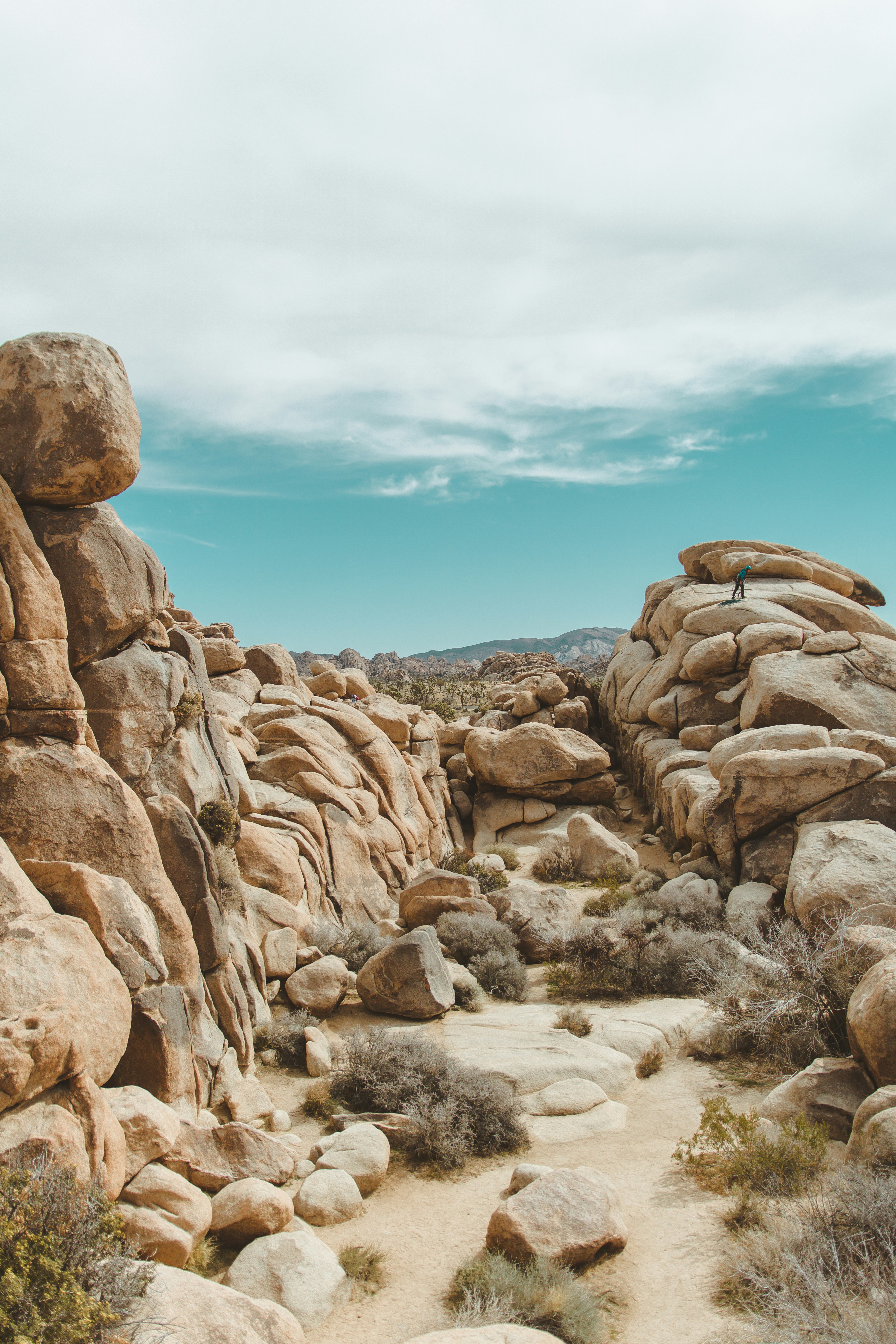
UNESCO has added 12 new sites to its Global Geoparks network, expanding efforts to protect significant geological landscapes while also supporting local communities and promoting sustainable tourism. With these latest additions, the total number of UNESCO Global Geoparks has risen to 241 across 51 countries, covering more than 8.82 lakh sq km worldwide—an area roughly comparable to Venezuela.
Here is a look at what these geoparks are and where they are located, highlighting the diversity of landscapes and the geological importance that led to their designation.
Changshan UNESCO Global Geopark, China
Changshan UNESCO Global Geopark sits at the junction of the Yangtze and Cathaysia massifs along the Jiangshan–Shaoxing tectonic belt. It records over a billion years of Earth’s history through clear rock layers and rich fossils, key to studying early life and geological change. Its mountainous terrain supports diverse biodiversity and evergreen forests under a subtropical monsoon climate.
Culture and livelihoods: Roughly 300,000 people from nine ethnic groups live here. The region has links to the Maritime Silk Road and Song Dynasty literary traditions, while farming of citrus and tea-oil camellia remains important for local incomes.
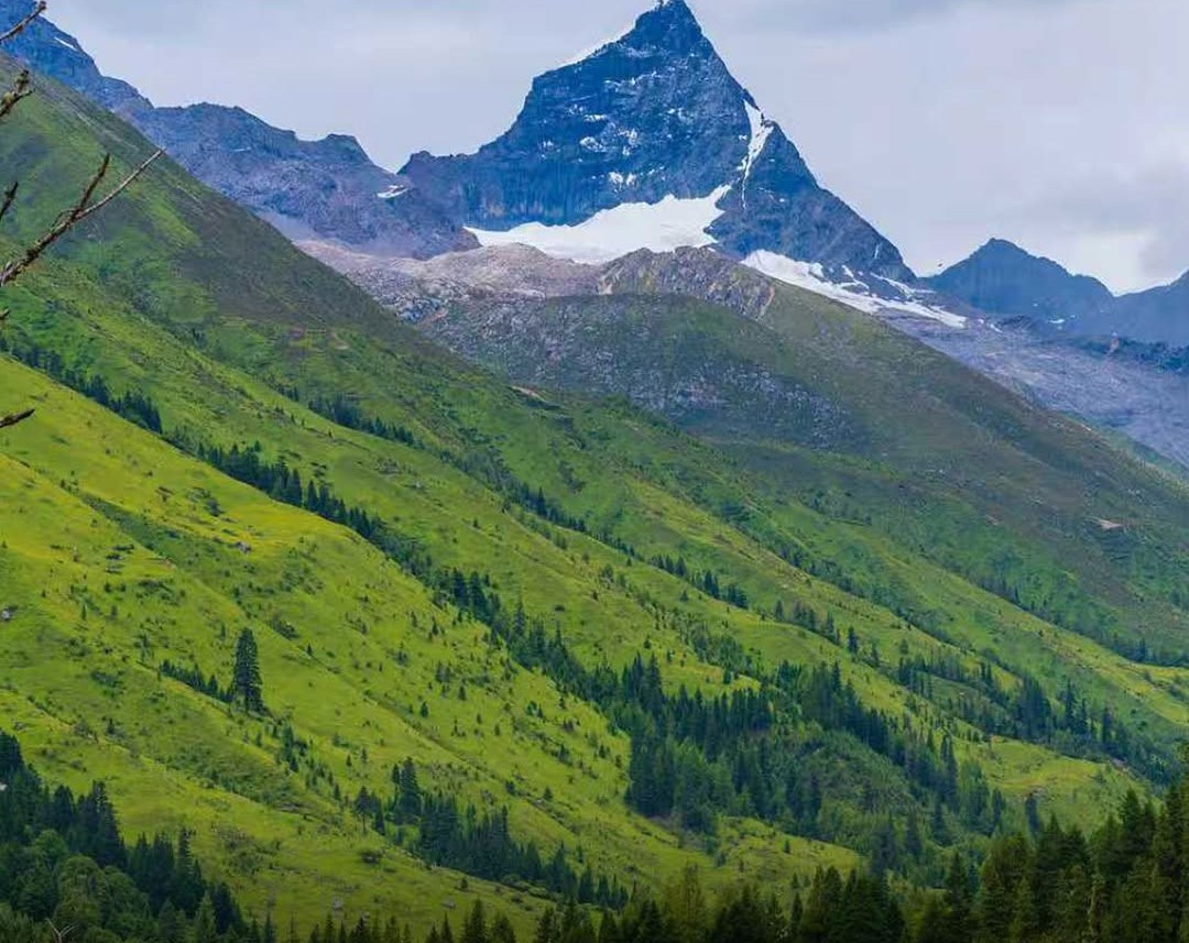
Mt Siguniang UNESCO Global Geopark, China
Mt Siguniang Geopark lies on the eastern edge of the Qinghai–Tibet Plateau, where sharp alpine relief and clear climate zones change with altitude. The area is shaped by strong tectonic movement, with high granite peaks, many rising above 5,000 metres. Rivers such as the Fubian, Wori and Xiaojinchuan carve through the terrain, forming drainage patterns that reflect the ongoing uplift of the plateau. Deep valleys and fast-cut river systems also reveal how the Qinghai–Tibet Plateau has been lifted over time.
Culture and livelihoods: About 33,000 people, mostly Jiarong Tibetans, live here. The life here is shaped by high-altitude pastoral farming and Tibetan traditions. A yearly pilgrimage festival and growing tourism help support both income and cultural practices.
Terres d’Hérault UNESCO Global Geopark, France
Terres d’Hérault Geopark in southern France takes its name from the land (“terres”) and the Hérault River that runs through the Occitanie region. The landscape is marked by canyons, uplands and rock formations that record more than 540 million years of Earth history. Places such as the Navacelles cirque, Salagou’s red sandstone landscape, and the Coumiac quarry show different chapters of Earth’s past in one region.
Culture and livelihoods: More than 100,000 people live across 112 communes here. Vineyards and grazing land follow the shape of the hills, while Occitan language and customs are still present in everyday life. Local building styles, farming and settlement patterns all reflect the surrounding geology.
Nisyros UNESCO Global Geopark, Greece
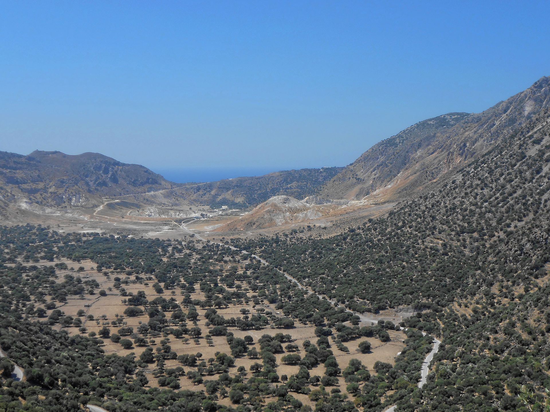
Nisyros Geopark sits in the southeastern Aegean, within the Dodecanese islands, and is centred on one of Greece’s most active volcanic systems. The island is dominated by a well-preserved caldera, with craters, lava domes and hydrothermal fields that show ongoing volcanic and geothermal activity. The Stefanos crater and surrounding volcanic features form a clear record of young volcanism within the Hellenic Volcanic Arc.
Culture and livelihoods: Small communities live among volcanic landscapes, using stone-built villages and terraced fields shaped by past eruptions. Local life blends farming, traditions and festivals, while schools and community groups are involved in protecting both heritage and environment.
Joyce Country and Western Lakes UNESCO Global Geopark, Ireland

This geopark in western Ireland covers landscapes shaped over about 700 million years, with strong links to ancient mountain-building events. Its terrain includes varied rock types, fossil sites, and glacial landforms, along with Ireland’s only fjord at Killary Harbour. Karst systems in the east add caves, springs and fast-moving groundwater features. The area shows a mix of igneous, sedimentary and metamorphic rocks shaped during major tectonic events. Glacial and limestone landscapes, including extensive cave and spring systems, reveal long-term geological change.
Culture and livelihoods: About 60 per cent of the geopark lies in a Gaeltacht region where Irish is still widely spoken. Music, storytelling, crafts and sports remain central to community life, while local language and traditions continue alongside small businesses and sustainable tourism.
Miné-Akiyoshidai Karst Plateau UNESCO Global Geopark, Japan
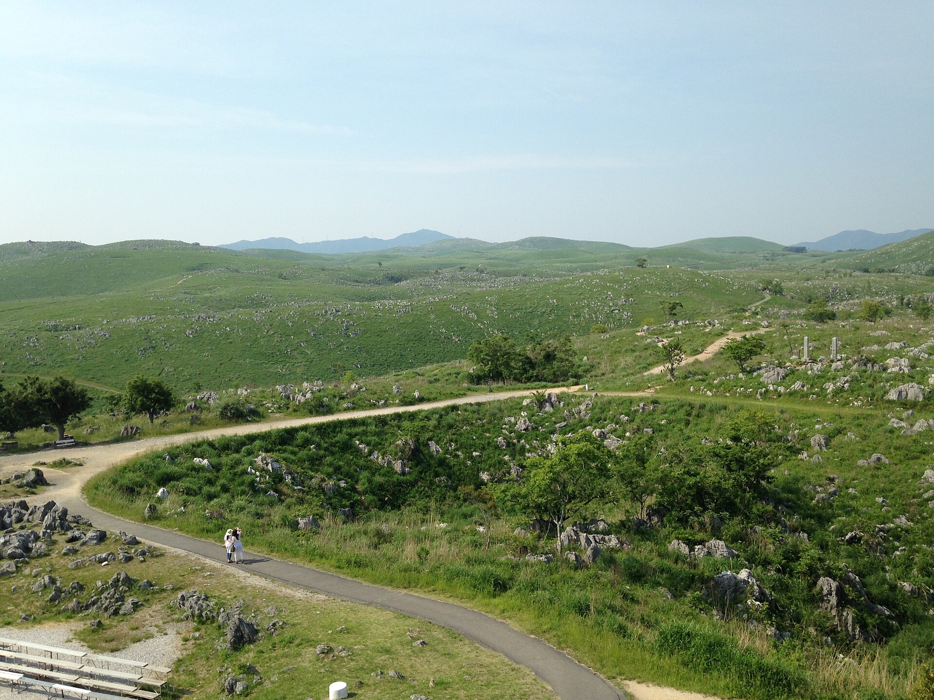
Miné-Akiyoshidai Geopark in western Japan is known for its vast limestone plateau and extensive cave systems formed over millions of years. The Akiyoshidai karst landscape, shaped by erosion and underground water flow, is one of the largest in Asia, with sinkholes, limestone pavements and deep cave networks such as Akiyoshidō.
Culture and livelihoods: Local communities have long adapted to the rocky terrain through farming on karst soils and managing limited water resources. The area also supports tourism linked to its caves and open grasslands.
Lenggong UNESCO Global Geopark, Malaysia
Lenggong Geopark in Perak lies between the Titiwangsa and Bintang ranges, with river terraces, limestone hills, and granite highlands shaped by long geological activity. The area contains records of ancient volcanism, meteorite impact debris, and ash from the Toba eruption. You can also see rich rainforest ecosystems.
Culture and livelihoods: Around 61,000 people live here, including Orang Asli communities. Farming, aquaculture and tourism support daily life, while the Lenggong Valley’s archaeological sites—stone tools, burials and ancient settlements—show one of the longest records of early human activity.
Sarawak Delta UNESCO Global Geopark, Malaysia

The Sarawak Delta Geopark in western Malaysia lies on a major tectonic boundary associated with the breakup of Gondwana over 200 million years ago. The landscape combines river deltas, coastal plains, and inland highlands, with a geological history stretching back more than 250 million years.
Culture and livelihoods: Over 600,000 people live in the area, including in Kuching, a UNESCO City of Gastronomy. Daily life reflects strong ethnic diversity, with food culture, festivals and traditional dances such as the Bidayuh Eagle dance. Farming, aquaculture and crafts remain important, alongside growing ecotourism.
Algarvensis UNESCO Global Geopark, Portugal
Algarvensis Geopark in southern Portugal’s Algarve region spans about 330 million years of geological history. Its landscape combines limestone, coastal formations and ancient tectonic structures, along with evidence of past volcanic activity. Notable features include tsunami deposits linked to the 1755 Lisbon earthquake and the Loulé Salt Mine, a long-used underground resource site and the deepest publicly accessible point in Portugal.
Culture and livelihoods: The region blends Mediterranean ecosystems with a long human history, from megalithic sites to Roman and Islamic heritage. Tourism dominates the coastal economy, especially in summer. The inland villages rely more on farming and crafts. Visitors can explore these rural areas and support local traditions, gastronomy and sustainable development.
Toratau UNESCO Global Geopark, Russia
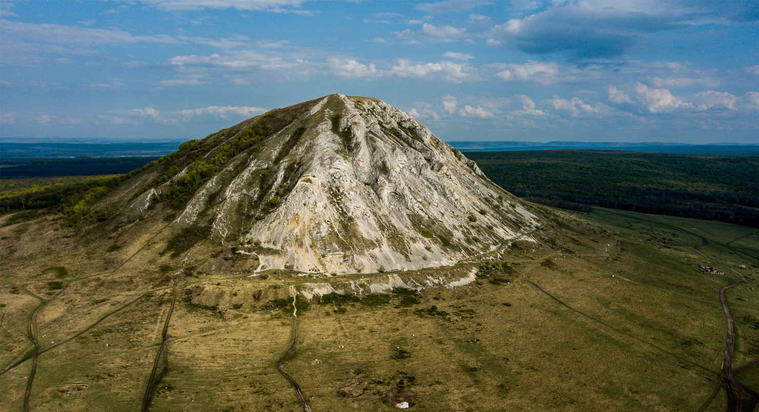
Toratau Geopark lies between the southern Ural Mountains and the East European Platform in Bashkortostan. Its rocks span nearly a billion years of Earth history. The landscape is best known for the Shikhany hills—Toratau, Yuraktau and Kushtau—which are remnants of an ancient reef system formed around 280–300 million years ago, along with caves, gorges and river valleys that expose the region’s geological layers.
Culture and livelihoods: The area contains traces of old settlements and fortifications that reflect long human occupation. Today, local communities are involved in guiding, crafts and food traditions, with geopark activities creating jobs and supporting education programmes that connect residents to both cultural and natural heritage.
Dahar UNESCO Global Geopark, Tunisia
Dahar Geopark in southern Tunisia lies on the edge of the Saharan Platform. It has a geological record stretching back about 250 million years. The area’s layered rock formations preserve traces of major Earth changes, including the early stages of the Tethys Ocean opening and the breakup of the supercontinent Pangaea. The area also includes Jebel Tebaga, known for rare marine fossils from the Upper Permian period.
Culture and livelihoods: Around 330,000 people live in the area, where farming and livestock are adapted to dry conditions. Traditional water systems, ksour (fortified granaries) and cave dwellings show long-term adaptation to desert life. Tourism is growing, with local crafts, food and heritage forming part of the visitor experience.
Manantiales Serranos UNESCO Global Geopark, Uruguay
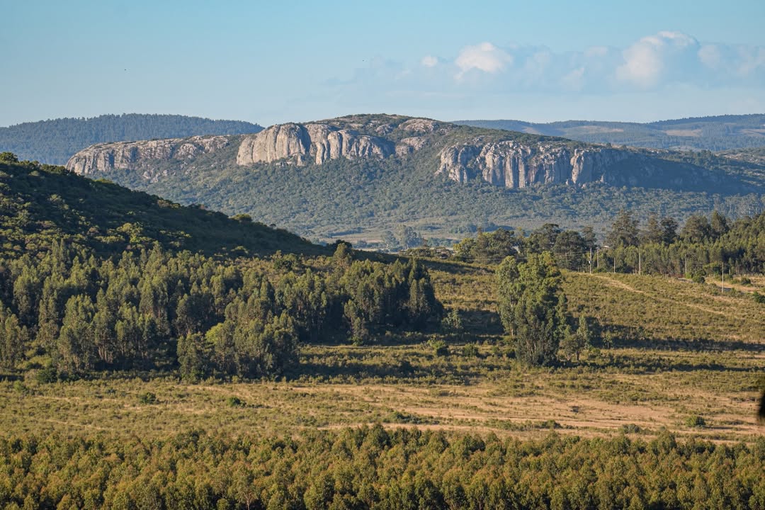
Manantiales Serranos Geopark in southeast Uruguay (Lavalleja Department) is shaped mostly by ancient metamorphic and igneous rocks. Its geology records deep time processes tied to the assembly and breakup of supercontinents such as Rodinia and Gondwana, as well as later events linked to the opening of the Atlantic Ocean and long phases of uplift and erosion.
Culture and livelihoods: The geopark includes the headwaters of the Santa Lucía River, which supplies drinking water to a large part of Uruguay. Communities such as Minas, Solís de Mataojo and Villa Serrana depend on farming, livestock, mining and tourism. Local identity is closely tied to the landscape, water sources and rural traditions.
FAQs
What is a UNESCO Global Geopark?
A UNESCO Global Geopark is a defined area with internationally significant geological heritage. It is managed in a way that combines protection of landscapes, education about Earth history, and sustainable local development.
How are geoparks different from national parks?
While national parks often focus mainly on conservation, geoparks also include education, geology-based tourism, and community development. They link natural heritage with local culture and livelihoods.
How many UNESCO Global Geoparks are there?
As of early 2026, there are 241 UNESCO Global Geoparks across 51 countries, reflecting a growing global network of protected geological sites.
Who manages UNESCO Global Geoparks?
Geoparks are managed through a bottom-up approach, meaning local communities, authorities, and stakeholders play a central role in decision-making and day-to-day operations.
Why are geoparks important?
They help protect unique geological landscapes while supporting local economies through sustainable tourism. They also raise awareness of Earth’s history and promote conservation through education and community involvement.