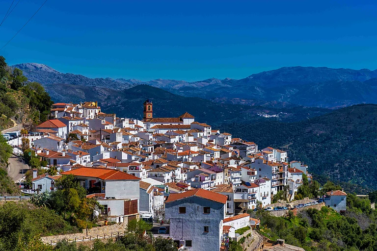
Spain is a playground for hikers and cyclists alike, with trails that take you from mountains to coastlines. You can hop on a bike in the Pyrenees, stroll along the coastline, or hike the Lakes of Covadonga Trail. Follow the coastal Camí de Ronda along the Costa Brava, ride the Vías Verdes, or journey the Camino de Santiago, walking or cycling its French, Portuguese, or northern routes.
The Lakes of Covadonga Trail
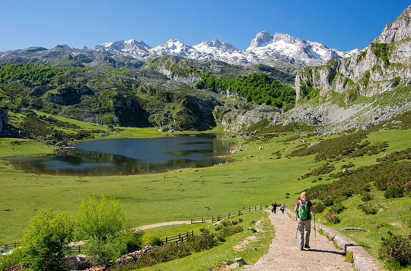
Take a hike to the Lakes of Covadonga in the heart of Picos de Europa National Park, just over 20 km from Cangas de Onís. The route leads into high mountain scenery where the glacial lakes of Enol and Ercina sit above 1,000 metres, surrounded by rolling green pastures and limestone peaks. A simple 5 km circular trail begins at the Buferrera car park and is fully signposted, making it suitable even for casual hikers. For those with less time, a shorter version can be completed in just over an hour.
A short drive of about 12 km brings you to the Santa Cueva and the Basilica of Covadonga, a revered pilgrimage site carved into the rock. The cave of Our Lady, with its small waterfall and sacred fountain, adds a quiet, spiritual contrast to the open mountain landscape. Nearby Cangas de Onís is a good base to stay, known for its Roman bridge and relaxed rural atmosphere.
Tips
You can reach the area by your own vehicle and adjust the hike to suit your time and fitness. Check access rules before you go, as they can change. Weather in the area shifts quickly—sun one moment, mist the next—so pack layers and a waterproof. Good walking shoes are essential on the uneven mountain paths. Go early to avoid the crowds and enjoy the clearest views over Enol and Ercina. Bring water and snacks, as there are few facilities along the route, and take your time—this walk is best enjoyed slowly, with plenty of stops along the way.
Camí de Cavalls Trail
Camí de Cavalls is a historic trail that traces the coastline of Menorca, offering one of the most memorable long-distance hikes and cycling trails in Spain. Stretching for around 185 kilometres and divided into 20 stages, the route takes you through the varied landscapes that earned the island Biosphere Reserve status. You can pass through pine woods, open countryside and dramatic coastal cliffs, with regular glimpses of some of Menorca’s most beautiful coves and beaches.
The name Camí de Cavalls, meaning “Horse Path”, dates back to the 14th century when a royal order required Menorcan knights to patrol the island’s coastline on horseback. British and French troops later used the same route for defence. Today, the restored trail forms a complete circuit of the island and can be explored on foot, by bicycle or on horseback.
Tips
The trail is well-signposted (GR223), but carrying a map or app is essential. Hike through rugged northern cliffs, red-sand beaches, pine-shaded southern coves, and turquoise waters. It is best navigated in spring or autumn to avoid summer heat. Remember to close all gates behind you and carry plenty of water and snacks. Day hikes are possible using local buses.
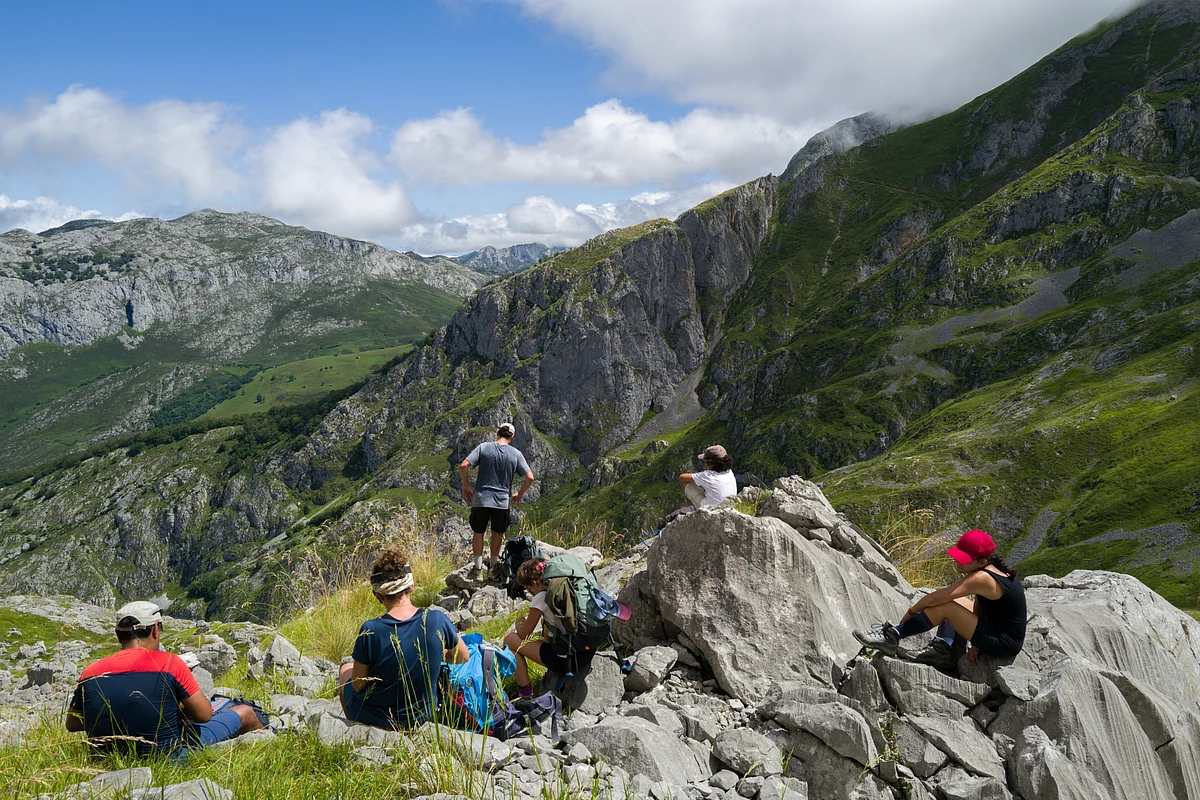
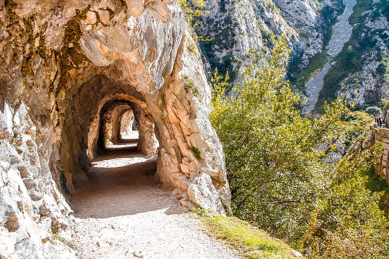
The Cares Trail
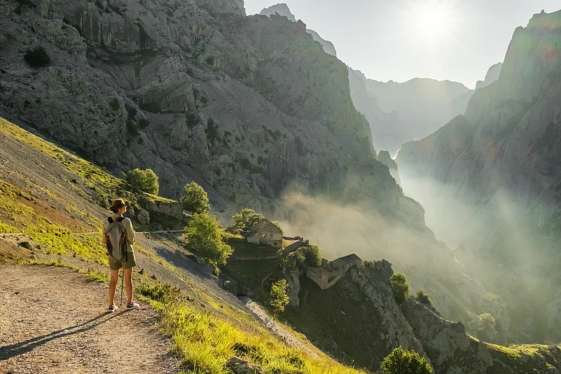
Known as the “Divine Gorge,” the Cares Trail winds between Caín in León and Poncebos in Asturias, cutting through one of the most dramatic gorges in Spain. The 12–15 kilometre path follows the Cares River, with limestone cliffs soaring more than 2,000 metres above the trail. Along the way, hikers cross small bridges, pass through around 70 tunnels carved into the rock, and enjoy spectacular views of peaks steeped in local legend and alpine landscapes. This narrow gorge path is famous for its breathtaking scenery and the sense of walking through a hidden mountain world.
Tips
The Cares Trail is a dramatic 22–24 km walk. Carved into sheer rock, the narrow gravel path is mostly flat and easy to follow underfoot. Most hikers take 6–8 hours to walk from Poncebos to Caín and back, though many choose a one-way route with a return transfer. Shorter sections are also possible if you don’t want the full distance. The trail is fairly accessible, even for children used to walking, and you can turn back at any point or just enjoy part of the route if time is limited.
Spring and autumn offer the most comfortable conditions, while summer can be hot and crowded. There is no drinking water or services along the route, so carry sufficient supplies. Check the latest information on open stretches before starting, as conditions can change due to maintenance or weather.
Greenways (Vías Verdes)
Imagine following the trail of disused railway lines. That’s Spain’s Greenways, or Vías Verdes - over 140 rail lines transformed into more than 3,500 km of safe, car-free trails, ideal for hiking and cycling. These gently graded paths wind through scenic landscapes, old viaducts, tunnels, and restored train stations, offering a slow-travel experience of Spain’s cultural and natural heritage. Many stations now serve as cafés, bike rental points, museums, or even hotels, making the routes accessible and comfortable for all ages and fitness levels.
Popular trails include the Vía Verde del Aceite in Andalusia, passing through olive groves and historic viaducts; Vía Verde de la Sierra, with its dramatic mountainous terrain; Asturias’ Senda del Oso, a wildlife-rich “Bear Trail”; and Vía Verde de la Terra Alta in Tarragona, showcasing Catalonia’s rocky countryside.
Tips
Routes are non-motorised and generally flat, making them suitable for beginners, families, and seniors. Spring and autumn are the best seasons to avoid extreme heat, particularly in the south. Trail maps and updates are available at viasverdes.com.
Ordesa y Monte Perdido National Park – Cola de Caballo Trail
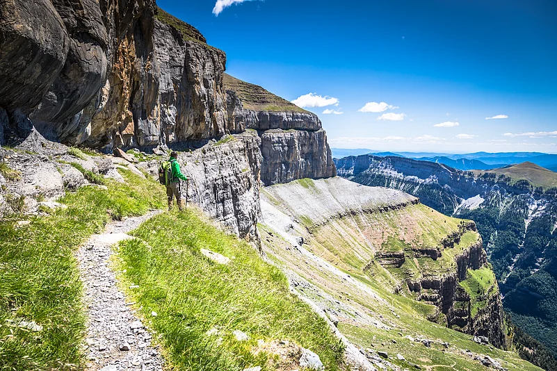
If you want to experience one of the most stunning hikes in the Spanish Pyrenees, the Cola de Caballo trail is a must. Over 17.5 km round-trip, you’ll follow a well-marked, moderately challenging path through the glacial Ordesa Valley. As you walk from Pradera de Ordesa, you’ll pass meadows, beech forests, and towering limestone cliffs, encountering some of the park’s most impressive waterfalls, including Arripas, La Cueva, and the tiered Gradas de Soaso. The trail finishes at the Circo de Soaso, a broad glacial valley beneath the soaring Monte Perdido, which rises to 3,355 metres. It is also the base to climb some of the tallest peaks.
Tips
The best time to hike is in late spring, summer, or early autumn. During busy periods, the road to Pradera de Ordesa is closed, so you’ll need to take the shuttle from Torla. You can follow the lower riverside path for an easier walk, or take the upper “fajas” for sweeping panoramic views. Torla-Ordesa is your main base, offering hotels, cafés, and a visitor centre. Make sure you have sturdy shoes and plenty of water for the full trail. There are huts available in higher altitudes, but advance booking is essential due to high demand.
Camí de Ronda, Costa Brava
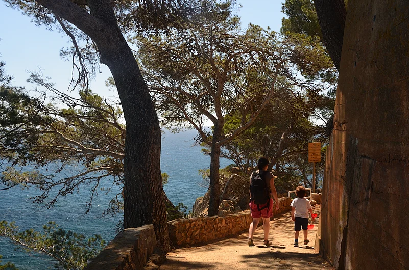
If you want to discover the beauty of Catalonia’s coast, the Camí de Ronda is a must. This historic trail hugs the rugged Costa Brava, with the main section running from Sant Feliu de Guíxols to Begur, about 43 km, though you can also explore the full circular route of around 140 km. As you walk, you’ll leave roads behind and pass cliffs, hidden coves, pine forests, and fishing villages, all with the deep blue Mediterranean beside you. Whether you want a few hours of strolling or a multi-day adventure, the trail offers something for everyone. Along the way, you’ll enjoy breathtaking viewpoints, sparkling beaches, and the charm of coastal Catalonia.
Tips
You can hike the Camí de Ronda all year, but spring and autumn bring the best weather. The trail is moderate, with ups and downs, narrow paths, and some rocky sections, as well as easier stretches through towns. Highlights include the Sant Feliu de Guíxols to Begur stretch via Palamós and Llafranc. Keep an eye out for dolphins, octopuses, and Peregrine Falcons. The route is well marked and there’s plenty of accommodation along the way, whether you’re doing a day trip or a longer hike.
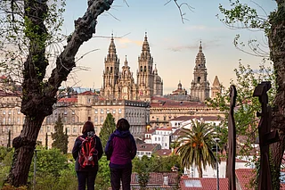
Camino de Santiago
If you want to experience one of Europe’s most famous pilgrimages, the Camino de Santiago is an unforgettable journey. You can walk or cycle along historic paths that lead to Santiago de Compostela Cathedral, passing through villages, forests, and farmland along the way. The most popular route, the Camino Frances, runs about 800 km from Saint-Jean-Pied-de-Port to Santiago and usually takes 5–6 weeks. You might also try the Camino Portugues from Porto, the northern coastal Camino del Norte, or the scenic, more challenging Camino Primitivo from Oviedo.
Navigating the Camino de Santiago trail is straightforward, guided mainly by bright yellow arrows painted on trees, rocks, walls, and roadsides. The scallop shell (vieira), the Camino’s symbol, also appears on signs and milestones, often pointing towards Santiago.
The route is very well marked, and it’s hard to get lost if you stay attentive, even for first-time hikers.
Along the trail, you’ll stay in albergues (hostels), and encounter fellow pilgrims from around the world.
You can earn the Compostela by walking any continuous 100 km (or cycling 200 km) on a recognised Camino route, as long as you finish your pilgrimage in Santiago de Compostela.
For example, you might complete a 100 km stretch elsewhere on the Camino and then continue to Santiago, finishing your journey at the Cathedral. The certificate must still be collected in person at the Pilgrim’s Office.
Tips
Make sure you train in advance and break in your shoes. Keep your backpack light, ideally around 10% of your weight. The best weather is late spring or early autumn. Pick up a Credencial to collect stamps, and plan your albergue stays ahead, especially in busy areas.
For more information, visit Spain Tourism's website
FAQs
When is the best time to visit for hiking or cycling?
September–October is ideal to avoid extreme heat, especially in southern Spain. Spring and early autumn also work well, with cooler temperatures in the north.
What are the top hiking and cycling routes?
Key routes include the Camino de Santiago (French and Portuguese Ways), the 2,400 km Vías Verdes network, the TransAndalus mountain bike route, and challenging climbs in the Pyrenees or Andalusia.
Are there family-friendly trails?
Yes. Many Vías Verdes (Greenways) are flat, traffic-free paths converted from old railways, ideal for families and beginners.
How do I navigate the trails?
Apps or GPS devices work well for both hiking and cycling. Signage is good on major routes like Camino de Santiago, but rural paths may require digital navigation.
Where should I stay while on these routes?
Look for “bike-friendly” accommodation, such as hotels, casas rurales, or hostels that offer secure bike storage and tools. Staying in rural areas can also mean quieter roads and scenic surroundings.
Can I transport my bike on trains?
Yes, most trains including AVE (high-speed) allow bikes, but you may need to book in advance and follow specific rules.
Are there regional tips for hiking and cycling?
Northern Spain (Asturias, Basque Country, Picos de Europa) is great for mountains and scenic routes. Southern Spain (Andalusia) is sunnier and hilly. Coastal regions like Valencia and Catalonia offer milder weather and scenic rides.