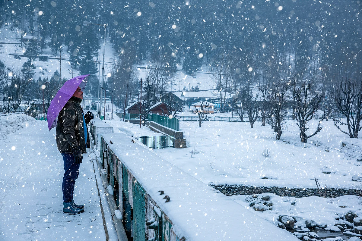
The higher elevations of Kashmir experienced their first snowfall of the season on Friday (Oct 3), with meteorological officials forecasting further snow and moderate rainfall between October 5 and 7 due to an approaching western disturbance.
Among the areas blanketed by early snow were Affarwat, located in the renowned ski destination of Gulmarg in north Kashmir’s Baramulla district, and Sinthan Top in the southern district of Anantnag, officials confirmed. Meanwhile, parts of the plains — including Srinagar and nearby areas — recorded light rainfall, marking the onset of the region’s transitional weather.

IMD Predicts More Snow, Rain And Sharp Temperature Drop
The India Meteorological Department (IMD) has reported that the higher reaches of Jammu and Kashmir witnessed the season’s first snowfall on Friday, with fresh snow recorded in several locations. Light rainfall was also observed across parts of the plains, including Srinagar and its surrounding areas.
An active western disturbance is expected to affect Jammu and Kashmir and adjoining areas from October 5, bringing a fresh spell of widespread precipitation. According to an official advisory, “Under the influence of this system, widespread light to moderate rain and snowfall (in the higher reaches) are expected in Jammu and Kashmir from October 5 to 7, with peak activity from Sunday night to Tuesday morning.”

The IMD further stated that moderate to heavy snowfall is very likely in the higher elevations of several key mountain passes and regions. These include Pahalgam, Kulgam, Sinthan Pass, Shopian, Pir Ki Gali, Sonamarg, Zojila Pass, Razdan Pass (Bandipora), Gulmarg, and Sadhna Pass (Kupwara). In addition to precipitation, the weather system is expected to bring a significant drop in temperatures across the region. “Apart from snowfall, there is a prediction of a drastic drop in temperatures. The IMD expects an 8–10 degree fall in temperatures,” the department said.
Chill Ahead: La Niña Set To Deepen Winter
The IMD and climate experts warn that the 2025–2026 winter may be significantly harsher than usual across India, largely due to the ongoing La Niña phenomenon. Northern regions, including Delhi and the NCR, are expected to face colder-than-average temperatures, more frequent cold waves, and prolonged foggy spells.
La Niña, marked by unusually cold sea surface temperatures in the eastern and central Pacific, strengthens the Walker Circulation. This intensifies cold, dry winds from higher latitudes into northern India. Additionally, La Niña leads to more frequent and intense western disturbances, bringing rain and snowfall to the Himalayas. These combined effects result in a notable drop in temperatures and an overall colder winter across much of northern India.
(With inputs from PTI)
FAQs
What caused the first snowfall in Kashmir this season?
A western disturbance triggered snowfall in the higher reaches of Kashmir, including Gulmarg and Sinthan Top.
When is the next spell of snow and rain expected?
The IMD predicts widespread rain and snow in J&K between 5 and 7 October, with peak activity from Sunday night to Tuesday morning.
Which areas are likely to see heavy snowfall?
Higher reaches like Gulmarg, Sonamarg, Sinthan Pass, Zojila, and Sadhna Pass are expected to receive moderate to heavy snowfall.
Why is a harsher winter forecast for 2025–26 in India?
The ongoing La Niña phenomenon is expected to bring colder-than-normal temperatures, more cold waves, and dense fog, especially in North India.
How does La Niña affect winter in India?
La Niña strengthens cold winds and western disturbances, bringing more snow to the Himalayas and chilling northern plains.