Humans have always used maps to conquer tough terrain, especially mountains. The romance of hand-drawn sketch maps, now rendered obsolete by digital reproductions, was captured by The Himalayan Club in 12 volumes of the Himalayan Journal, the first of which was published in 1929. Some of these sketches have found their way, along with articles on the respective expeditions, in a new gorgeous leather-bound book, Legendary Maps From The Himalayan Club (Roli Books), which seeks to portray 90 years of Himalayan exploration.
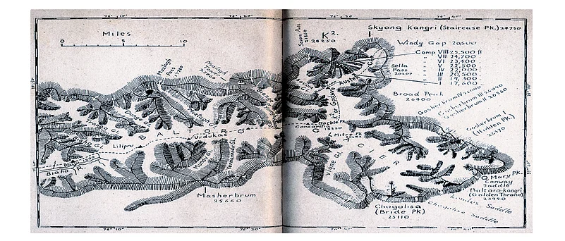
The two sketch maps we have published here represent failed attempts to summit two contrasting peaks that were once related by name.
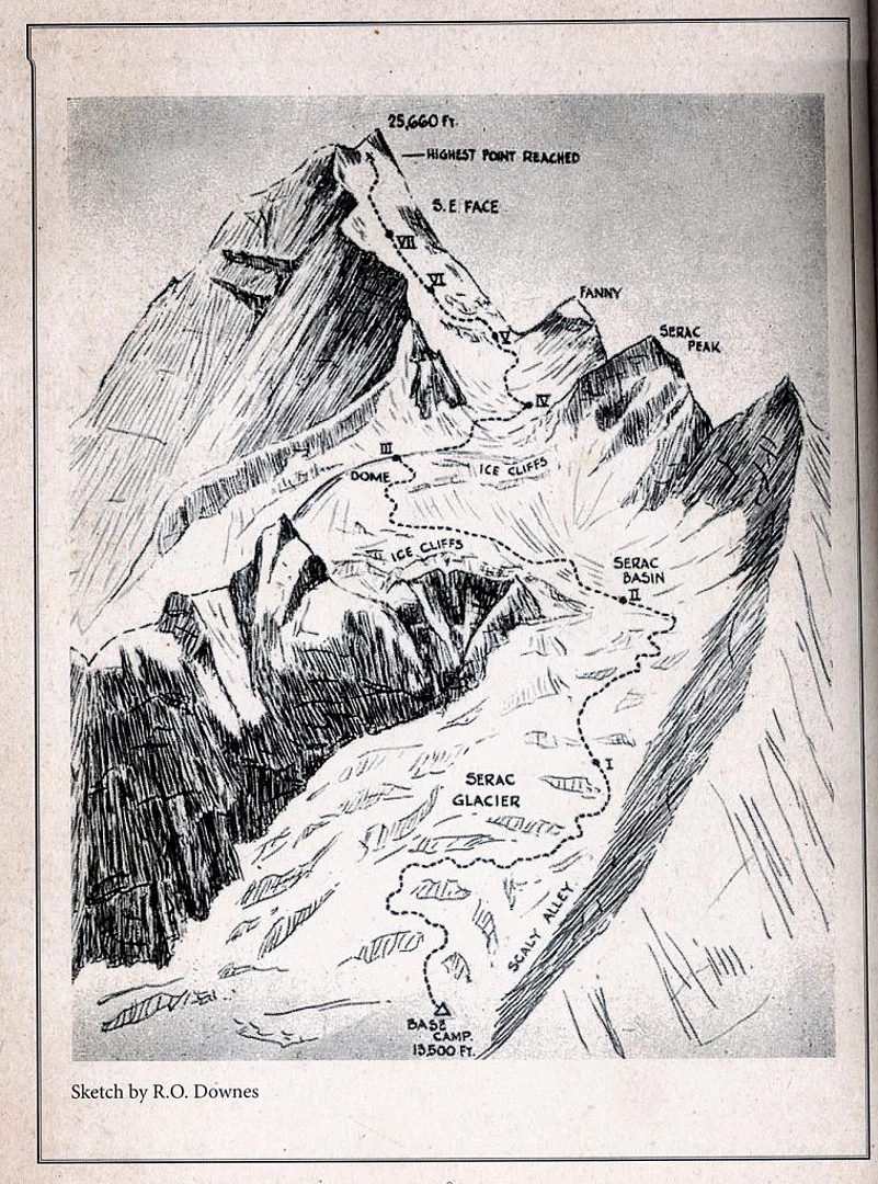
The picture above shows the Masherbrum peak (25,659 ft), which an 1856 survey named K1 for this was the first surveyed peak in Karakoram. Located in Ghanche district, Gilgit Baltistan of Pakistan, this peak saw its first successful summit by Americans in 1960. But before that came a series of failures. One such failed attempt is shown in this map. In 1957, a British team set up seven camps on the mountain and made several trips from the base camp to the last one, but failed to summit. One of the mountaineers lost his life on Camp VI due to altitude sickness, and the others feared frostbites before retreating.
The second map (pic above) is that of the third American Karakoram expedition of 1953 to K2, the second highest mountain in the world at 28,251 ft. The attempt was led by Charles Houston who had found a possible route 15 years earlier. Hit by an unrelenting storm at Camp VIII, the team was stuck 3,000 feet from the summit for days and suffered from dehydration. One of the team members, Art Gilkey, was diagnosed with thrombophlebitis and had to be rushed down. He was eventually lost to an avalanche during the descent. Nobody knows what power the mountains wield over the human mind. Whether its conquest we seek on our own planet or the solitude of the summit, our species will continue to explore the most hostile of terrains. We may fail, but these maps are proof that we tried. n