India’s Bureau of Indian Standards has issued a major update to the national seismic zonation map as part of the revised Earthquake Design Code, reclassifying the entire Himalayan arc into a newly created highest-risk category called Zone VI. The change follows modern probabilistic hazard modelling and decades of seismological research, and it revises long-standing district and state-level assumptions about earthquake exposure. The new map will affect how public authorities, builders and tourism operators plan, build and market destinations across mountain India.
What A Seismic Map Is And How Scientists Build One
A seismic zonation or seismic hazard map is a scientific tool that shows how strong ground shaking is likely to be at different places over a given time period. Rather than recording past earthquakes only, modern maps use Probabilistic Seismic Hazard Assessment, which combines the location and behaviour of active faults, historical earthquakes, tectonic plate motions, local geology and models of how seismic waves attenuate with distance. Scientists then translate those hazard numbers into design categories that tell engineers how strong structures must be to survive shaking. The National Centre for Seismology and related agencies provide the monitoring and modelling that feed these maps.
Dr Vineet Gahalaut, Director of the Wadia Institute of Himalayan Geology and former head of the National Centre for Seismology, explained that the Himalayan belt remains inherently vulnerable to earthquakes. Placing the region in Zone VI, he said, provides a clearer framework for understanding the scale of potential hazards and the level of damage that could occur, rather than predicting specific earthquakes. He added that the updated classification should encourage all stakeholders, from government departments to hospitality operators, to re-evaluate existing risks, strengthen safety norms, upgrade weak structures, and adopt more transparent and reliable disaster-preparedness practices.
Dr R Jayangonda Perumal, scientist, Wadia Institute of Himalayan Geology, shared with Outlook Traveller that the foundation of India’s updated approach to designing buildings that can withstand earthquakes– the 'Design Earthquake Hazard and Criteria for Earthquake-Resistant Design of Structures — Code of Practice' prepared by the Bureau of Indian Standards this year. The code, he shared, outlines the minimum engineering requirements for most structures and provides a unified method for calculating seismic forces. The updated standard incorporates a refined understanding of how ground motion varies across the country and aligns with the new seismic zonation system introduced this year.
The code devotes significant attention to how engineers should analyse the behaviour of buildings during ground shaking. It details how response spectra are to be used, how damping and structural configuration affect earthquake performance, and how realistic load combinations must be applied to ensure accurate assessments. It is emphasised that the intention is to bring consistency to seismic design practices so that structural safety can be evaluated on a reliable scientific basis.
The revised standard also classifies buildings according to their purpose and importance, which determines the level of protection they must meet. Structures in high-hazard zones are expected to comply with stricter requirements related to ductility, separation distances, torsion, and soil interaction. By strengthening these provisions, the updated code aims to ensure that both new construction and retrofitted buildings reflect India’s latest seismic knowledge and contribute to a more resilient built environment.
Why India Updated The Map And What Changed
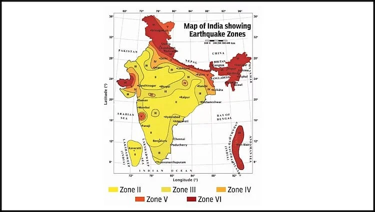
The 2025 update, released alongside revisions to the Earthquake Design Code, replaces older maps that leaned heavily on historic epicentres and administrative boundaries. The new approach applies physics-based modelling to estimate likely shaking from locked and potentially rupturing fault segments, producing a more continuous and geology-driven hazard pattern. The most dramatic formal change is the introduction of Zone VI, which places the entire Himalayan arc from Jammu and Kashmir through Uttarakhand, Himachal Pradesh and Sikkim to Arunachal Pradesh into the highest-risk category for the first time. Reports say roughly 61 per cent of India’s landmass now falls into moderate to high hazard bands under the new classification, a recalibration that will ripple into design standards and planning rules.
Speaking to Outlook Traveller, Dr M Ravichandran, Secretary, Ministry of Earth Sciences, explained that the revised map is the outcome of a far larger and more precise body of information than was previously available. "New observations from additional locations and a significantly expanded dataset allowed the National Centre for Seismology to redraw the seismic profile of the country before forwarding it to the Bureau of Indian Standards," he said.
According to him, advancements in technology, especially improved seismometres, have delivered far more accurate readings. "With increased observations and better calibration, the updated map reflects the refined results and may undergo another revision in about a decade," he informed.
Rather than relying solely on historic earthquakes and administrative boundaries, experts used physics-based modelling that takes into account active fault lines, tectonic plate movement, local geology, and ground-shaking behaviour over time. With more extensive data and improved monitoring (better seismometres and more observation points), the map represents a refined hazard assessment, aimed at predicting likely ground shaking rather than reacting to past quakes.
What The New Map Means For Travel And Tourism
At the most immediate level, the map does not close roads or cancel visits. It does, however, change the rules that govern how buildings, hotels, heritage sites and transport infrastructure must be designed, approved and insured. Tourist facilities in the newly highlighted high-risk areas will face stricter construction and retrofit requirements, mandatory compliance checks for lifeline structures such as hospitals and bridges, and closer scrutiny for large new projects. For travellers, the practical consequences are likely to include more visible retrofitting work, intermittent closures during upgrades, and new advisories on safe-built accommodations and evacuation routes. Tourism-dependent local economies may need to invest in safer infrastructure, which could raise costs but also create an opportunity to market safer, resilient stays.
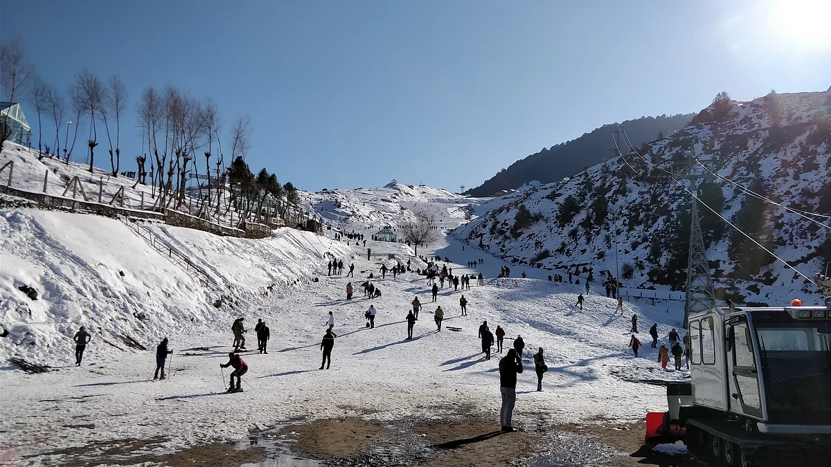
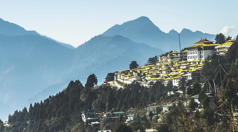
The Himalayan states and union territories that host the region’s most famous tourism draws are among those now formally in Zone VI. Popular destinations such as Leh and Ladakh, Shimla, Manali, Dharamshala, Dehradun and Nainital, Gangtok, Darjeeling and large parts of the northeast hill country now lie in higher hazard territory. Lowland gateways to the hills, including parts of Delhi and the Indo-Gangetic plains, remain sensitive too because earthquakes in the mountains can produce strong shaking in distant cities. Travellers should check whether hotels and activity providers have up-to-date safety certifications, ask about evacuation plans, and be prepared for occasional infrastructure works or closures while essential retrofits and code-compliant upgrades are carried out.
For the travel industry, the map is a prompt to reassess risk, reprice insurance and invest in resilience. Governments are likely to tighten permitting and land-use rules in sensitive corridors and prioritise retrofitting of schools, hospitals and heritage buildings that receive tourists. For communities that rely on pilgrimage and seasonal visitors, the shift offers a chance to win longer-term confidence by showcasing resilient buildings and emergency preparedness. Over time, better-designed infrastructure and transparent safety practices can become a competitive advantage rather than a liability.

The new seismic map does not make India’s mountains off-limits. What it does is trade complacency for clarity. Travellers will benefit if authorities, operators and local communities use that clarity to build and advertise safer experiences. For anyone planning a trip to India’s hills, the sensible response is to travel informed: pick reputable, code-compliant accommodations, learn simple earthquake safety steps, and treat the new map as a tool that helps everyone enjoy the mountains more safely.
FAQs
1. What is the new seismic map released by BIS?
The Bureau of Indian Standards issued an updated seismic zonation map under the 2025 Earthquake Design Code, introducing a new highest-risk category, Zone VI.
2. Which regions now fall under Zone VI?
The entire Himalayan arc—from Jammu & Kashmir, Himachal Pradesh and Uttarakhand to Sikkim, Arunachal Pradesh and large parts of the Northeast—now lies in Zone VI.
3. How does the updated map affect travel and tourism?
While travel remains open, hotels, resorts, bridges and public facilities in high-risk regions must follow stricter construction, retrofitting and compliance standards.
4. Will travellers face restrictions in these areas?
No blanket bans are expected, but visitors may see temporary closures for upgrades, more frequent safety checks and advisories recommending code-compliant stays.
5. How can travellers stay safe in high-risk seismic zones?
Choose certified accommodations, ask about evacuation plans, avoid poorly built structures, and learn basic earthquake safety steps before visiting hill destinations.