


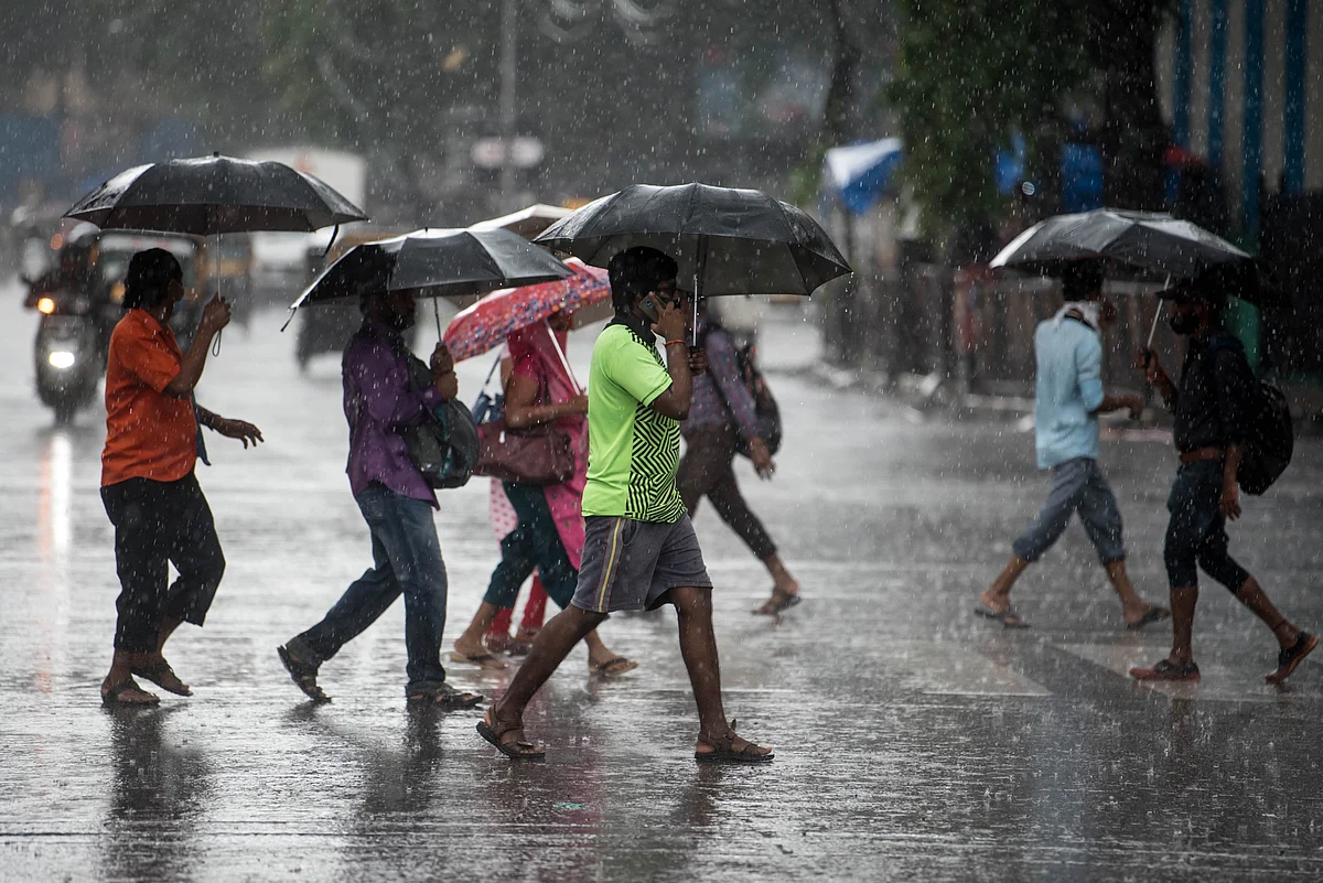
The Bay of Bengal is once again shaping travel plans along India’s eastern coast, with a deep depression making landfall near Kalingapatnam in Andhra Pradesh in the early hours of September 24. While social media has widely dubbed the system “Cyclone Arnab,” the India Meteorological Department has classified it as a deep depression, with winds reaching 55–65 kmph and gusting up to 75 kmph.
With heavy rain, rough seas, and possible disruption to road, rail, and air travel across parts of Andhra Pradesh, Odisha, and neighbouring states, travellers need to keep a close eye on weather alerts before setting out.
Where Did The System Originate And What Was Its Route?
The system began as a weather disturbance over the north Andaman Sea and adjoining areas. On September 17, the IMD said a low-pressure area was likely to form over the Andaman Sea around September 19. The low-pressure area subsequently developed and moved into the east-central Bay of Bengal, before intensifying into a depression on September 21 and a deep depression as it travelled west-northwestwards.
Its route then took it across the Bay of Bengal towards the north Andhra Pradesh and south Odisha coasts. By September 23, the system was close to Kalingapatnam and was forecast to cross between Visakhapatnam and Gopalpur. The IMD ultimately recorded landfall near southwest of Kalingapatnam between 11 p.m. on September 23 and 1 a.m. on September 24.
At 5:30 a.m. on September 24, the deep depression was centred over north coastal Andhra Pradesh, approximately 50 km west of Kalingapatnam, 80 km north-northeast of Visakhapatnam and 170 km southwest of Gopalpur in Odisha.
At landfall, the system had maximum sustained winds of 55–65 kmph, gusting up to 75 kmph. That puts it below the IMD's threshold for a cyclonic storm. A cyclonic storm has an average wind speed of 62–88 kmph, while a deep depression has an average wind speed of 50–61 kmph.
So while travellers may see the term “Cyclone Arnab” across social media, the official weather classification remains a "deep depression."
How Long Will The Weather System Last And Which Areas Are Affected?
The system is expected to continue moving northwestwards while maintaining deep-depression intensity for around 12 hours from the morning of September 24. It is then forecast to turn north-northwestwards and weaken gradually over the following 24 hours. The IMD expects it to weaken into a depression on September 24 and subsequently into a well-marked low-pressure area by September 26.
For travellers, however, weakening does not mean that conditions immediately return to normal.
Andhra Pradesh and Odisha remain the main areas of concern, with heavy to very heavy rainfall and isolated extremely heavy rainfall possible in parts of the two states. The system is also expected to influence rainfall across Chhattisgarh, Telangana, Jharkhand, Gangetic West Bengal, and parts of Madhya Pradesh.


In Odisha, authorities have continued to warn of heavy rain after the system's landfall. Puri has restricted sea bathing, with red flags raised along the beach, while travellers have been advised to avoid entering the water.
West Bengal is also seeing weather effects from the system. The IMD has warned of heavy to very heavy rain in parts of south Bengal, while thunderstorms, lightning and gusty winds are possible in several districts. Kolkata and surrounding areas could experience waterlogging, reduced visibility, and traffic disruption during intense spells.
What Should Travellers Do?
If you are travelling through coastal Andhra Pradesh or Odisha, check the latest IMD warning before setting out, particularly if your journey involves beaches, hill roads, rural roads, or areas prone to flooding.
Travellers should avoid unnecessary movement during periods of intense rain, stay away from beaches and rivers, and follow instructions from local authorities. Those driving should expect slower journeys because of waterlogging, poor visibility, and fallen trees or debris.
Air and rail travellers should also check directly with their airline or railway operator before leaving for the airport or station, as weather-related disruption can change at short notice.
The IMD has advised fishermen not to venture into the sea along the affected areas, with dangerous sea conditions continuing around parts of the Bay of Bengal.
Emergency Numbers To Keep Handy
India Meteorological Department weather information: 1800-180-1717
Odisha State Emergency Operation Centre: 0674-2534177
Odisha State Disaster Management Authority: 0674-2395398 / 0674-2395531
Andhra Pradesh State Emergency Operations Centre: 1070 / 1800-425-0101 / 83339 05022
Andhra Pradesh 108 Emergency Service: 108 for medical, police, and fire emergencies.
West Bengal State Control Room: 1070 (toll-free)
State Control Room, Nabanna (West Bengal): 033-2214-3526
FAQs
1. Is Cyclone Arnab an official cyclone?
The India Meteorological Department has classified the weather system as a deep depression rather than a cyclonic storm. The term “Cyclone Arnab” has been widely used on social media and in some reports.
2. Where did the deep depression make landfall?
The deep depression crossed the north Andhra Pradesh and adjoining south Odisha coast close to southwest of Kalingapatnam during the night of September 23-24, 2026.
3. Which states are affected by the deep depression?
Andhra Pradesh and Odisha are among the main affected areas, with weather impacts also extending into Chhattisgarh, Telangana, Jharkhand, Gangetic West Bengal and parts of Madhya Pradesh.
4. Is it safe to travel to Odisha and Andhra Pradesh during the deep depression?
Travellers should check the latest IMD warnings and local authority advisories before travelling, particularly for coastal areas, beaches, flood-prone roads and locations experiencing heavy rain.
5. What should travellers do if their flight or train is affected by bad weather?
Check directly with the airline or railway operator before leaving for the airport or station, as weather-related delays, cancellations and route disruptions can change at short notice.