A 24-hour journey in a UP Roadways bus is not the most comfortable way to get to Munsiyari, I realise, as I count the numerous bumps on my head the morning after. I had been rudely awakened several times during the journey &ndash most notably around midnight, when the bus followed in hot pursuit of a rabbit, the passengers cheering on the driver. (The rabbit was finally caught, put in a sack and locked up in the glove compartment.)
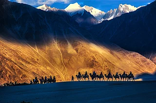
But when I stepped off the bus in Munsiyari, all memories of the bizarre journey vanish -- the five mythological Pandavas stand proud before my eyes, their legend forever ensconced in the five majestic peaks of the Panchchuli range. Situated in a remote corner of Kumaon bordering Tibet and Nepal, Munsiyari was once a bustling entrepot of trade. On a trekking trail north-west of Munsiyari is the Milam Glacier, one of the longest in the region. The four-day trek to the village of Milam at the end of this old trade route to Tibet is dotted with abandoned Bhutia villages. In the wake of the India-China war of 1962 trade came to a halt and the hardy Bhutia traders migrated to the towns and cities below.
I am eager to set off on the trek to the glacier. Mr Rare, the KMVN (Kumaon Mandal Vikas Nigam) manager, is helpful and tells me that his father, Khem Nam, could act as guide on my trek. Khem Nam turns out to be fully 65 years old, a veteran of these valleys. We make a list of provisions and set off shopping at the Munsiyari bazaar, a stronghold of the Bhutia traders. As I make my purchases, the shop-owner proudly tells me that his daughter and son-in-law hold important IAS posts in Delhi. The Bhutias, who once ruled the trade routes may have lost their metier, but they have retained their enterprise.
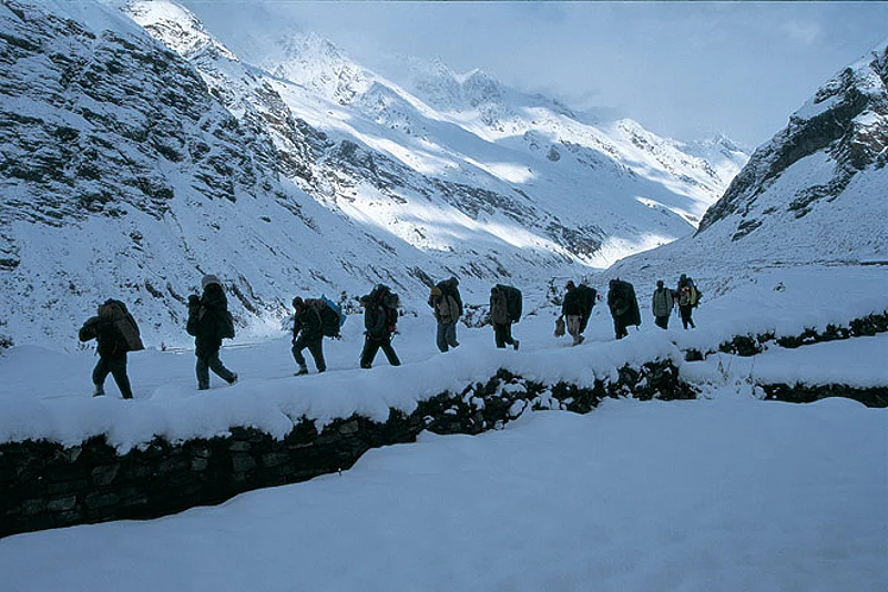
It is heartening to meet Laxmi, our porter, the following morning. He is a sturdy young man and seems like just the support frail Khem Nam and I need. Rucksacks loaded, we head straight down to the Gori river.
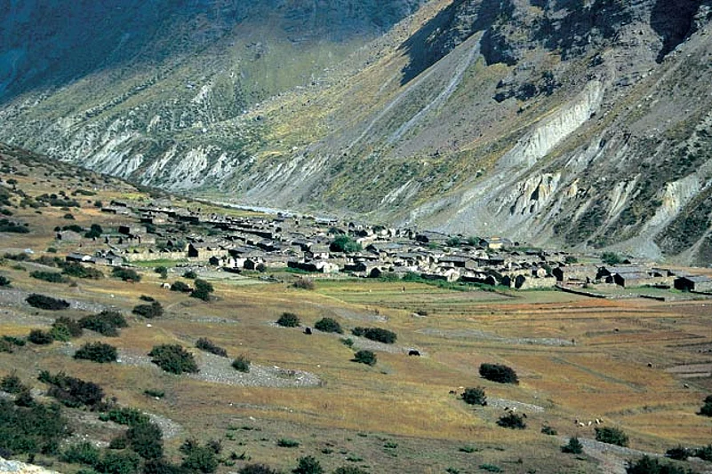
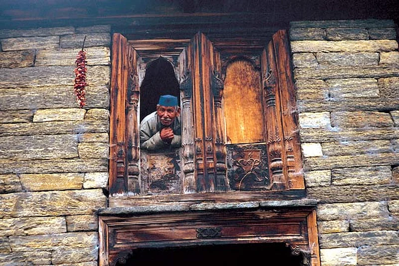
For three days our path first takes us upstream along the Goriganga, and then into the shrouded Milam valley where the narrow gorges afford few views. Abandoned Bhutia villages dot our path and I increasingly get the feeling that we are traversing a long-forgotten route. On the fourth day we cross the ghost villages of Burfu and Bilju before we reach Milam. At 3,800m, it probably has the dubious distinction of being the highest abandoned village in the world. Except for some ITBP jawans and a few locals tending to their fields of jhambu (a local herb), the once 500-household-strong village is deserted, a mass of ruins amongst overgrown weeds. Old carvings on doorless frames tell stories of a culture once rich in arts and crafts. Khem Nam, who was a porter in the old trade days, remembered it as a bustling trading outpost. His stories brought to life the Ghyani Mandi of Tibet, where Indian traders sat on one side and Tibetans on the other, trading their wares by the old barter system. Those days, Milam was a frontier trading post and the last Indian village on the nine-day trek to Tibet.
It is now our sixth day on the trek it has rained the whole night and the morning brings even drearier weather. At over 4,000m, firewood is hard to come by. Keeping warm is tough, and distraction the best recourse. The weather plays truant for most of the day, raising doubts about the feasibility of our venturing further up. Howling winds, clouds, bright sunshine and hailstorms chase each other through the skies, and I spend the day moseying in and out of our cave.
We were camped at Ragash Kund, a little pond with a shepherd&rsquos cave on a grassy meadow above the glacier, where we sat out the bad weather for two days and nights. From Milam village it had taken us a day to get to our current position, en route to Suraj Kund which (as I was later told) takes a detour via heaven because &ldquoyou gotta be dead first&rdquo before you get there. The rains of 1997 had caused a lot of damage to the terrain and we were told that no one had ventured beyond the snout of the glacier that year. But Khem Nam was not to be deterred. &ldquoI know the glacier like the back of my hand, I will find us a way,&rdquo he insisted. His confidence was heartening &ndash my map did, after all, show a trekking trail and I was fascinated with the idea of seeing this sacred lake nestled in a far nook of the glacier.
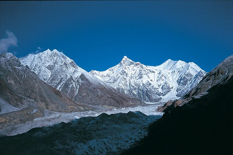
The following morning brought azure skies and breathtaking views of the glacier and the surrounding peaks. Spread-eagled at my feet lay the vast Milam Glacier system. More than half a kilometre wide and some 27km long, the crevasse-pocked glacier looked like a surreal frozen river with fissure-like volcanoes turned upside down and icy cold waters gurgling beneath. The summits of Hardeoli and Trishuli at the glacier&rsquos head were unreal in their consummate beauty, a tremendous icefall starting off the glacier from their base. Trishuli, &lsquoShiva&rsquos trident&rsquo, was plastered with slopes of white snowfields and Hardeoli&rsquos steep and stark cliffs were, simply, formidable.
On the slope opposite our camp was the fascinating summit of Mandyo, which spiralled up into the blue sky like a giant corkscrew. Slapped with steep cliffs on all faces, it looked every inch an insurmountable peak. To my immediate right the Nanda Pal glacier sloped down sharply. It could easily have been built up as a very challenging ski slope except, of course, for the fact that it ended in a cold and menacing snout with icy waters flowing beneath. I felt as if I had trespassed on some hidden and forbidden world of beautiful peaks and ominous glaciers. For the locals the glaciated region is one to be feared -- a land of demons and spirits waiting to devour the unholy, but for the avid trekker a journey into what is literally a no man&rsquos land can be the experience of a lifetime.
To see the cold snowy peaks coming to life with the first rays of the sun was simply magical. Getting to Suraj Kund was now the task at hand. Entire slopes had, well, slid down, taking with them the centuries-old path. To my untrained eye, the glacier looked impossible to walk on. Luckily, Khem Nam thought otherwise -- he had done a recce the previous evening and was now sure of our route.
After a big breakfast, we set off on the final leg of our pilgrimage to Suraj Kund. It was not an easy path -- we hopped over stones on landslides and delicately treaded on the glacier rubble. The majestic mountains towering all around still looked surreal, offering distraction from the fretful path. In all, nine smaller glaciers feed the Milam glacier system, each with its own set of peaks from which they emerge.
Crevasses dotted our route as Khem Nam, like Hansel, lined our route with dark stone markers to help us return. As we walked dead centre of the glacier, the 80m ice fall starting from the base of the Hardeoli and Trishuli peaks came into fuller view. The last leg was up a landslide. I turned a corner and there below in a hidden nook sandwiched between two glaciers stood the twin ponds of Dudh and Suraj Kund with the stunning icefall forming a magnificent backdrop. I greedily bent down to drink some water from the holy pond -- it was the sweetest I had ever tasted.
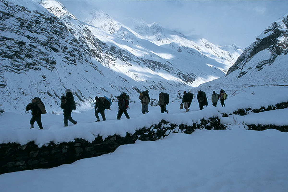
At two in the afternoon a light snowfall began to fall. Laxmi made us a nice cup of tea each with some twigs he put together for a fire, after which we decided to head back. At that time I had little idea that these weather conditions would not abate for the next few days and that an early winter had begun to settle in. It was a long haul back and we reached our camp at Ragash Kund only after nightfall.
The following morning we returned to Milam by afternoon, the skies were showering down snowflakes the size of my palm. It snowed continuously for the next three days and nights, leaving us stranded in the &lsquocivilisation&rsquo of Milam. Patience is an art well learnt when one is at the mercy of nature. Just when mine was beginning to wear thin, the skies cleared. The autumn landscape was turning wintry. I was out on the path by six -- there was something I was keen to see. Three kilometres down from Milam lay the ruins of Bilju. Icicles hung from abandoned roofs and fields of creamy snow lined the tops. Facing the ghost village stood the twin peaks of Nanda Devi main and Nanda Devi east. I was transfixed. It was like the view you get from Binsar, but with an 800mm zoom lens attached to your eyes
I looked deeply into its visage, trying to etch in my mind every detail of the vast expanse of the valley and the forlorn abandoned village, blessed by a goddess no less than Nanda Devi herself. I paid my obeisance, Khem Nam and Laxmi arrived, and we started back towards Munsiyari -- and traffic.
The information
Getting there From Delhi the UP Roadways bus for Munsiyari is not the best option, but is the only one that gets you across in one shot. Options take the train till Tanakpur and then bus it or hire a taxi to Munsiyari.
Where to stay The KMVN tourist complex in Munsiyari (059612-2339) has clean rooms with attached baths. The Martoli Family Guesthouse (Shanti Bhavan, Sarmoli 059612-2287) is a short walk from the bus stand.
Porters, guides, rations and permits Four days worth of rations need to be taken as Milam has a ration shop where you can stock up again. However, check status at Munsiyari. Mules are also available for carrying loads and come with a keeper. Porters usually manage to arrange for the utensils required for the trek. Ask the KMVN staff at the tourist complex to find you a guide/porters or enquire at the several local trekking agencies near the bus stand&mdashPanch Chuli Trekking (059612-2327) is good.All rations and provisions are available at the large Munsiyari bazaar.
You need an Inner Line Permit to trek in this border area. This is available from the District Magistrate&rsquos office near the bus stand in Munsiyari, and will be checked at various ITBP posts en route. Permits to stay in the PWD huts can be obtained from Munsiyari, but the huts have instructions to take in trekkers even without permits as long as they are vacant.
What to carry Warm inners, sweater, wind-cheater, comfortable shoes with a good grip, breathable cotton socks, raincoat, sunshade, sunscreen, sunglasses, Swiss Army knife, camera batteries and rolls, one change of clothes, sleeping bag, tent, first-aid kit.
Distances Munsiyari-Lilam 12km Lilam-Bogudiyar 13km Bogudiayar-Rilkot 12km Rilkot-Milam village 17km Village-glacier snout 4km Snout-Ragash Kund 5km Ragash Kund-Suraj Kund 18km. Total distance, one way 81km
Other treks in the region Ahead of Milam, a six-day route (a total of 11 days from Munsiyari) goes to Malari in Garhwal. Prior permission for the trek has to be sought from the Home Ministry.
Ahead of Rilkot from Martoli lies the Nanda Devi East base camp. It takes two days from Martoli to get to the base camp.
For mountaineers, the Long Staff Col (5,910m) and Traills Pass (5,312m) offer challenging hikes.