In mid-March, I got the opportunity to embark on a one-day journey for a heritage archaeological walk of Rakhigarhi. The walk was curated and led by Vinit Bhanwala, a young individual who is a consultant with the Department of Archaeology and Museums, Haryana. Bhanwala, along with the Department, has been conducting such archaeological walks since December 2023 to promote and create awareness of Haryana’s culture and heritage. As etched out by Bhanwala, the walk would go from Delhi to Rakhigarhi, where we would explore the historic site and indulge in a light, traditional Haryanvi lunch. The travellers would then head on to explore the Agroha mound that dates back to the 3rd century BC and contains the remains of an ancient town.
Rakhigarhi: A Bronze Age Metropolitan?
Early that morning, we assembled at Kashmere Gate and set off for our single-day engagement with the past in Rakhigarhi and Agroha. On our way, we stopped once for a light breakfast while the sunny winds of spring played around us. Straight after breakfast, we hit the road for Rakhigarhi. As we got closer to the site and entered Hisar, a sparse landscape grew out of the undulating sandy plains of the Aravalli outliers. Thatched huts, kutcha houses, uneven lanes and dryness dominated the area. A spectacle of dusty transparency and passive plantation grew. An elderly silence remained suspended in the atmosphere; with its geopolitical position, the terrain has borne the brunt of a tragic designation of being the battlefield of all wars for the control of Delhi. Everyone that came razed the site to the ground. Deaths, gunpowder, dismemberment, dryness, and horror have entailed the area, as we would later be told by the local guide, Bishwa Prakash Mishra.
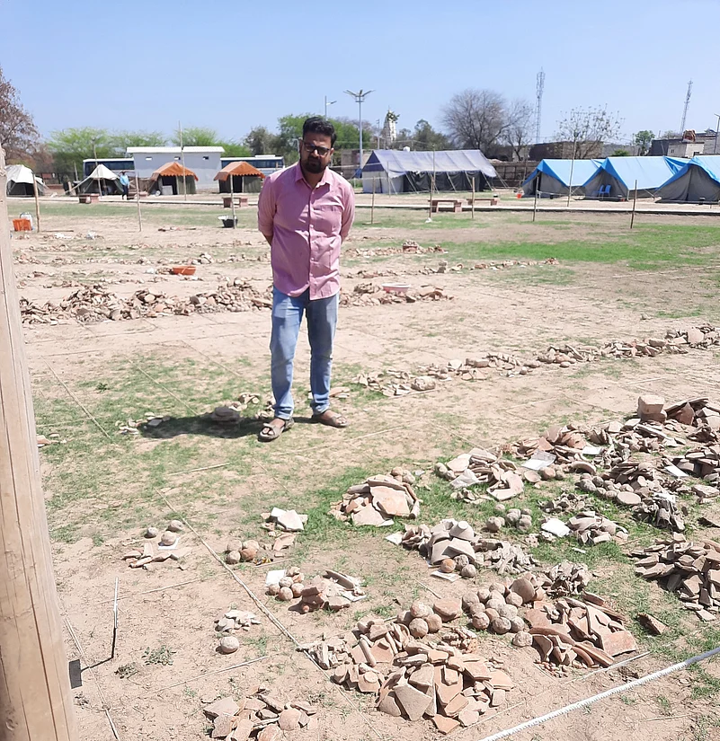
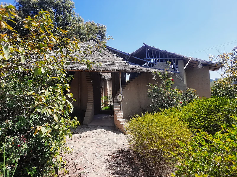
Once in Rakhigarhi, we entered an eponymous resort where we prepared to leave for the field exploration. Bishwa Prakash, who works there as a consultant tour guide with Astitva Heritage, gave us a brief of the site and got us to embrace “the auspicious time travel.” Dinesh Sheoran, the owner of the property, had managed to make the whole Rakhigarhi Resort in the image of an ancient town. Clay structures with rooms, stairs, and walls were all plastered on the outside with a layer of clay. In one corner lay the traditional cooking contraptions of Haryana, simple yet sophisticated.
Rakhigarhi is one of the largest and oldest cities of the Indus Valley or Harappan Civilisation. In Hisar, the site is situated under two modern villages, namely, Rakhi Shahpur and Rakhi Khas. The excavators and archaeologists involved in working on the mounds claim the site was one of the major metropolitan centres of the Harappan culture. The earliest work on the site goes as far back as 1969 when Prof. Suraj Bhan conducted several surveys and solidified the Harappan nature of the site. In the explorations that followed, and excavations carried out by the Archaeological Survey of India along with Deccan College, our guide Mishra's alma mater, it was established that a clustered settlement existed at Rakhigarhi across more than 500 hectares. These settlements were planned near the early Dishdvati River, an ancient tributary of the Sarasvati River, intelligible as the Chautang River in our modern world. Dr Amrendra Nath further continued Bhan's research in 1997-98 and 1999-2000 and unveiled various occupational phases beginning from the pre-formative stage to the mature Harappan period covering the time from 5 BCE to 3 BCE based on the radiocarbon dates obtained from various layers after excavation.
The site has a total of 11 mounds out of which 7 have been worked upon. It was on mounds 1, 2, 3, 4 and 5 that Prof. Bhan explored in the 1960s and was in a position to claim that Rakhigarhi could have been the provincial capital during the time of Harappan civilisation. While the village wasn't too big at that time, it witnessed a gradual settlement of various houses making it difficult to work around a few of the mounds.
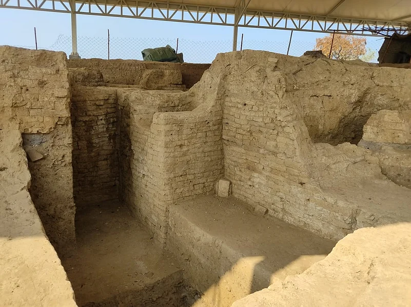
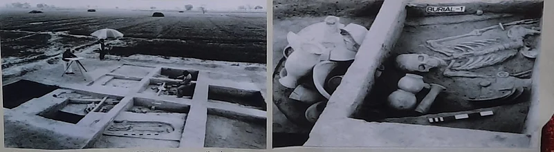
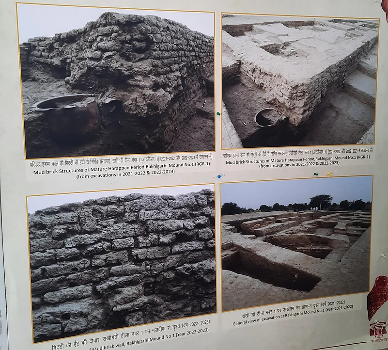
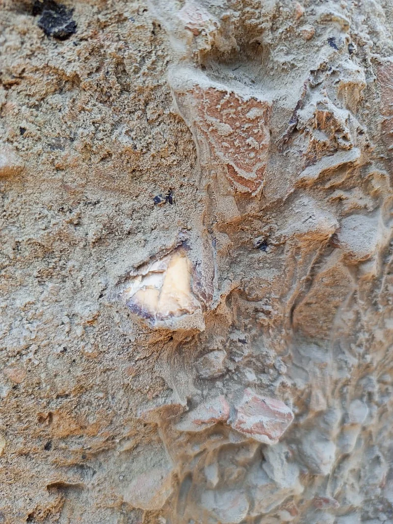
Excavations on Mound 1 that were carried out by the ASI in 1997-98 and 1999-2000 under Dr. Nath were again worked upon in 2021-22 and 2022-23. The investigation yielded evidence of antiquarian remains from the early to mature Harappan period. Among the findings were chambers for dyeing clothes, kilns for manufacturing potteries, lapidary industries for beads and semi-precious stones, burnt bricks, residential buildings made of sundried unbaked bricks, elaborate drainage systems made of burnt bricks, and fire altars. Mishra remarked that over 3,000 finished and unfinished beads of various materials were procured. All of this put the excavators and experts, including Mishra, in a position to surmise that the site must have been a thriving industrial centre. The discovery of other materials such as terracotta toys and jewellery, shell and stone ornaments, stone and copper tools and implements including chert blades, fluted cores, copper arrowheads, bone joints, and more, give us the picture that the city wasn't simply an industrial capital but bustling city where life went on with well-moderated checks and balances of the economy.
Based on the excavations, Mound 2, situated southwest of Mound 1, is speculated to have been a citadel mound. It is about 14 metres high. Excavations under Dr Nath revealed evidence of an enclosure wall with elaborate entrances towards the southwestern slope. Researchers found guard cells on either side of the gate on these entrances, similar to those found at other traditional city walls. The other structures unearthed from Mound 2 include a series of large podiums, sacrificial pit chambers, a granary (made of mud brick and thick mud plaster) having ten blocks for grain storage, a market complex, house complexes, a large network of street and public lanes, drainage system and two deep wells. Apart from this architecture, the researchers also found other objects that tell us much about life in this citadel city. These objects include beads in steatite, terracotta, shells, semi-precious stones, bone and ivory objects such as hairpins, spatula and square dice, in addition to a variety of pottery.
These findings echo on most of the mounds including Mounds 1, 3 and 7 where excavations are still in progress. The aim of the current excavations, which are parallel and not vertical, is to protect the sites from weathering and allow them to be present in the public domain. The Joint Director General of the ASI, Dr. Sanjay Kumar Manjul, inaugurated an interpretation centre and a photo gallery at the site in January this year. The idea is to promote awareness about the pivotal nature of Rakhigarhi as well as allow students from Pandit Deen Dayal Upadhyaya Institute of Archaeology to work and learn on the site.
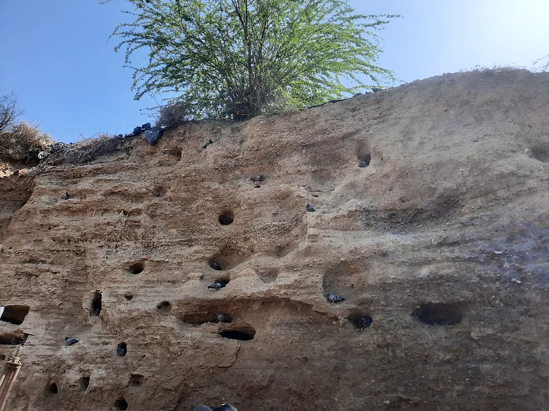
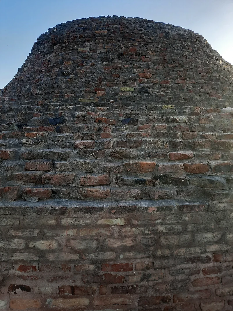
Speaking at the spot known as the "Parrot Wall" — a part of Mound 4 where the stratigraphy of various historical epochs can be observed in the soil — Mishra said that such protection is vital as it keeps the site intelligible and accessible as a knowledge-producer, calling the wall "an index; the content page of the book of Rakhigarhi." The Parrot Wall is a 22 metre-long mound within which can be traced 64 layers ranging from the early Harappan period to the late mediaeval period, said Mishra. A sedimentation of sinews, bones, blood and bread. Ironically, I noticed that the Parrot Wall, which is supposed to be inhabited by parrots, had been overtaken by pigeons, hegemonised and territorialised.
While the locals seemed miffed if interested in the whole job, I was informed by Sheoran about the imminent plans of integrating the locals into the on-goings at Rakhigarhi and bringing them into the economic fold. Apart from the photo gallery and interpretation centre, a whole new museum has also been constructed just beside the mounds, and work on its interior architecture, artifacts cataloguing and curation is ongoing after which the museum will be open to the public.
After a group picture at the Parrot Wall, we headed back to the Rakhigarhi Resort where we were treated to a sumptuous traditional Haryanvi thali. A variety of breads along with a preparation of mixed vegetables, yoghurt, daal and churma (coarsely ground wheat, crushed and cooked with ghee and sugar), a Haryana speciality, adorned our plates. Soon after our short feast, we bid adieu and thanked Sheoran for his hospitality and headed straight to the capital of the legendary king Maharaja Agrasen, Agroha.
Agroha Mound: The Remnants of Buddhism
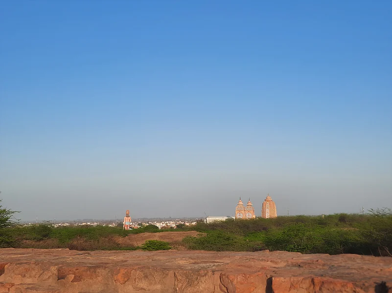
Situated beside National Highway-9, Agroha Mound is a one-hour drive from Rakhigarhi. Once at the place, we took a modern bricked-pathway which was a steep climb to reach the top of the mound. The bricked lanes and dry, gregarious trees around us made the sight resemble the locales of the JNU campus. Once at the top of the mound, Bhanwala, the leading guide of our tour, illuminated us with the myth and history of the site.
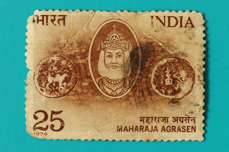
Bhanwala said that according to legend, Agroha was the capital of Agrasena some 5,000 years ago. Agrasena and Queen Madhavi chose the location of Agroha after finding tiger and wolf cubs playing together. They believed this was an auspicious sign that the area was Veerabhoomi, or “Land of the Brave.” As he recited the myth to us, I could see the three wings of the Agroha Dham looking huge and up-close though at some distance.
As I went closer to the wall at the other end of the mound, the three temple structures demagnified to appear visually congruent with the distance they actually were from where I stood. I briefly wondered if I had simply imagined it or if there was an actual involvement of perspective, seen in the Taj Mahal when it is viewed from its outer arched entrance or the arch at Musamman Burj at Agra Fort where Shahjahan was captured.
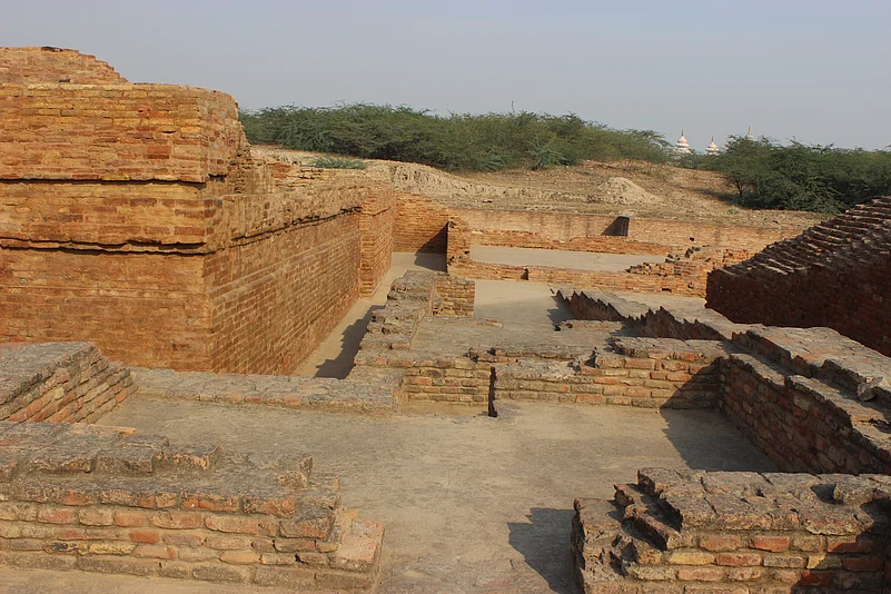
Excavations at Agroha began in 1888-89 under C.T. Rogers and resumed in 1978-79 by the Archaeological Department of Haryana. They revealed that the site dates back to the period from the 3rd-4th century BC to the 13th-14th century AD. The site features a defensive wall, shrine cells, and residential houses. The structures are similar in style to the slab-bricked buildings at Nalanda and Sarnath. Over 7,000 artefacts were found during the excavations, including silver and bronze coins from the Roman, Kushana, Yaudheya, and Gupta empires. The language used on the site is Prakrit, and many inscribed seals were discovered, including ones with phrases such as “Pitradutt,” “Sadhu Vridhasya,” “Shamkar Malasya,” and “Madrsya.” Buddhist structures are evident at the site, which once stood on the ancient trade route between Taxila and Mathura, making it a significant centre of commerce.
Once we had trudged and hopped and tapped and trundled, checked the texture of the bricks, and the layout of the structure all around the vast ancient remains of Agroha, we readied to head back to Delhi. On our four-hour ride home, some folks napped while others dreaded the traffic we might encounter just outside the city. Humbled and haggard with the kind of fatigue you feel after, a broad - and not long - day, I wondered how our layer of time would eventually end up as the 65th addition, another stratum, on the Parrot Wall. Did the mediaeval monarchs ever wonder on their ascent up to Delhi, having razed down structures and championed battles at Haryana, that they may end up merely a stratum on the Parrot Wall?