The Pin Parvati Pass in Himachal Pradesh connects the fertile and lush Parvati Valley on the Kullu side with the dry Pin Valley on the Spiti side. It sits at an altitude of 5334m above sea level. The trek to the pass is a popular one with nature lovers and hikers looking to soak in views of snow-capped peaks, high-altitude lakes and glaciers. The shepherds of the Spiti Valley often bring their sheep to graze here due to its lush greenery.
However, the trek is also challenging due to the steep terrain, rocky trails and river crossings. Build up your endurance and physical fitness prior to undertaking it. The journey is worth it though, with thickets of dense forests and meadows greeting you every step of the way. The best time to hike this route is from July to August and September to November.
Here’s your 11-day guide to completing it.
Day 1: Manali – Barshaini – Kalga

Drive from Manali to Barshaini, a 92km journey which will take around four hours. Thick pine forests and green grasslands will greet you on your drive. Once you reach Barshaini village, trek the 3km to Kalga and rest for the night.
Day 2: Kalga To Kheerganga

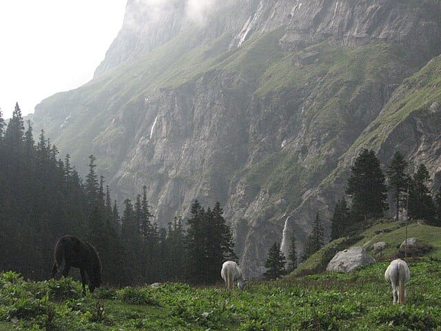
Start your trek to Kheerganga in the morning. It is situated around 2,900m above sea level and the 10km trek will take nearly seven hours to complete. You will cross the River Parvati, move through a forest and pass by lush meadows. Oak, chestnut and walnut trees line the route.
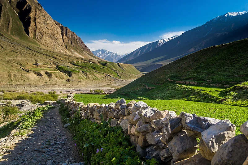
Day 3: Kheerganga To Tunda Bhuj

This 13km route cuts through grasslands and streams. The Pin Parvati Valley will come into view during your walk. The Tunda Bhuj campsite is surrounded by meadows and you will get a charming view of snow-capped Himalayan peaks. Relax with a hot meal.
Day 4: Tunda Bhuj To Thakur Kuan
Your trek today will have charming views of conifer and birch forests and blooming flowers. One of the most memorable experiences you will have is crossing a bridge over a roaring river. The trail is rocky and uneven in some places so be careful about where you place your feet. The camping site of Thakur Kuan is located at 3550m. The panoramic views of the Pin Parvati range from here are a sight to behold.
Day 5: Thakur Kuan To Odi Thach

Odi Thach is 3800m high and to get there you will cross grasslands and forests. While today will be the easiest walking day, you will have to face up to a tricky crossing of the Pandu Bridge. Follow the instructions of your guide and make your way across safely. The Odi Thach campsite will be very windy.
Day 6: Odi Thach To Mantalai Lake

Today’s 12km trek will take around eight hours to complete. Moving from an altitude of 3800m to 4150m, you will walk through a muddy and slippery section before passing onto a moraine. The trek will move sharply uphill at this point. The chances of developing Acute Mountain Sickness (AMS) are high so take adequate breaks, keep yourself hydrated, inform your guide and take the required medication, if needed. Mantalai Lake is the source of the Parvati River.
Day 7: Mantalai Lake To Pin Parvati Base Camp

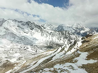
This 11km trek will take nearly six to seven hours to finish. You will walk past streams, rocky areas and icy glaciers. The ascent to Pin Parvati Base Camp involves traversing mountain slopes so be careful. On your way, enjoy the majestic peaks of Kinnaur, Kullu and Spiti. The camp is at an altitude of 4950m. It may be a tad uncomfortable to stay here overnight due to the rocky terrain.
Day 8: Pin Parvati Base Camp – Pin Parvati Pass – Pin Valley

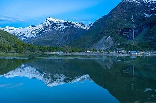
Today’s the day you reach your destination. Congratulations on having made it so far. Start your 15km trek early in the morning. The trail today will be steep and challenging as it involves crossing a glacier, moraines and boulders. Once you arrive at the Pin Parvati Pass, you will be able to see the Pin Valley towards Shrikhand Mahadev. Take in the moment fully.
On your descent you will notice snow-laden fields give way to grasslands. The trail is steep so hang on to your trekking poles for balance. The Pin Valley is known for its vibrant flora and fauna. Set up camp near the Pin River and take a well-earned rest.
Day 9: Pin Valley To Tiya

This 12km route will wrap up in six hours. The climb down will take you through a deserted trail surrounded by tall hills. You will be able to view the trail which leads to Bhaba Pass. Savour the scenic views of the mountains from the Tiya campsite.
Day 10: Tiya – Mud – Kaza
This will be the final day of your trek. The walk to the village of Mud (12km) in the Spiti Valley is flat. There will be sections where you will be walking on paved roads. Once you reach Mud, drive to Kaza, 25km away. The drive will offer you one last time to gaze upon the beauty of the mountains. Stay in a guesthouse overnight at Kaza. We recommend checking out the town’s local markets and cuisine. There are also many monasteries and temples in and around Kaza that you can visit.
Day 11: Kaza To Manali

The winding roads of the mountains will take you back to Manali today. The journey of 183km will take around five hours.
Getting There
The nearest railway station to Manali is Joginder Nagar (JDNX), 162km away. There are regular bus and taxi services to Manali from New Delhi and Chandigarh. The closest airport is Bhuntar Airport (49km) but due to irregular flights it is best to land at Chandigarh Airport (IXC), 276km away.