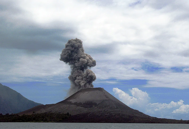
Indonesia consists of thousands of islands, many of which are known for their active volcanoes. On June 17, the Mount Lewotobi Laki-laki volcano in south-central Indonesia erupted, prompting authorities to raise the alert level to its highest status. The Indonesian Geological Agency reported that the volcano emitted thick gray clouds that reached an altitude of 10,000 metres (32,800 feet) which could be seen from cities located 90 to 150 kilometres away. Indonesia is known for its extensive archipelago, which comprises thousands of islands, many of which are influenced by geological activity due to a chain of active volcanoes.
Vulnerable To Volcanic Activity
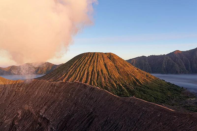
According to World Data, Indonesia has around 132 volcanoes of which 84 are considered active volcanoes, many of which are located along the Sunda Arc, and has suffered the highest number of eruptions resulting in fatalities and infrastructure damage. The country's high frequency of volcanic eruptions is primarily due to its location along the Pacific Ring of Fire, a region characterised by intense tectonic activity. The Pacific Ring of Fire is a horseshoe-shaped zone that encircles the Pacific Ocean, known for its frequent earthquakes and volcanic eruptions.
Indonesia is located at the intersection of several major tectonic plates, specifically the Eurasian, Pacific, and Indo-Australian plates. These plate boundaries form subduction zones where one plate slides beneath another. As the denser oceanic plate subducts, it melts due to the high temperatures and pressures found in the Earth's mantle. The resulting molten rock, known as magma, then rises through the crust and eventually erupts at the surface as volcanoes.
Notable Eruptions
Krakatoa (1883): A massive eruption that triggered a tsunami, resulting in widespread devastation and over 36,000 deaths.
Tambora (1815): Considered the largest volcanic eruption in recorded history, this event caused significant atmospheric effects and numerous fatalities, both directly and indirectly.
Mount Merapi: One of Indonesia's most active volcanoes, it is known for its frequent eruptions and the potential for pyroclastic flows, lahars, and ashfall.
Mount Sinabung: After being dormant for 400 years, it erupted in 2010, leading to evacuations and casualties.
Monitoring Volcanoes
Indonesia employs a multi-faceted approach to monitor volcanic eruptions, primarily through the Center for Volcanology and Geological Hazard Mitigation (PVMBG), which involves a combination of ground-based and satellite monitoring, hazard assessment, and early warning systems. They also utilize local knowledge and collaborate with international partners like the USGS to enhance their capabilities.
Satellite imagery, like MODIS and VIIRS, is used to monitor volcanic activity, particularly for detecting thermal anomalies and ash plumes. And sophisticated analysis techniques are applied to satellite data to extract valuable information about eruption events. PVMBG also develops and disseminates volcanic hazard maps, which are crucial for land-use planning and informing communities about potential risks