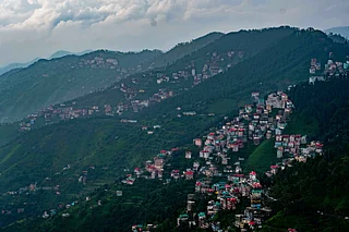
Encircled by low hills, forests and hilly springs, Netarhat nestles like a secret refuge in the heart of Jharkhand. Once home to several tribes, the hills caught the fancy of the British rulers, who converted it into a hill station. Then dubbed the "Queen of Chhota Nagpur," the hill station has moved far beyond its colonial days. Now known for its natural beauty and a public residential school opened in 1954, Netarhat is a weekend getaway from Ranchi, the state capital, about 150km away by road.
Reaching Netarhat from the plains is part of the fun. The rolling hills are covered with sal, palash and mahua trees. The steep hill road (ghats) cuts through the forests and runs past some sharp bends, finally flattening into a plateau that perches Netarhat at the height of 1,250 metres amidst cypress and pine trees. A huge gate welcomes you to the town.
The best place to stay in Netarhat is a tourist lodge run by state tourism. Aptly named, Prabhat Vihar offers the best sunrise view across the hills. So even if you are staying there, head early for the viewing gallery to take a vantage position because it does get crowded with visitors from other hotels too.
Hanuman's Birthplace
According to local beliefs, Hanuman (the Monkey God from Ramayana) was born in a cave in the nearby Anjan village, and it was here that he rushed to eat the sun, thinking it was a fruit. Ignore the story if you like, but do not miss the sunrise and sunset views in Netarhat.
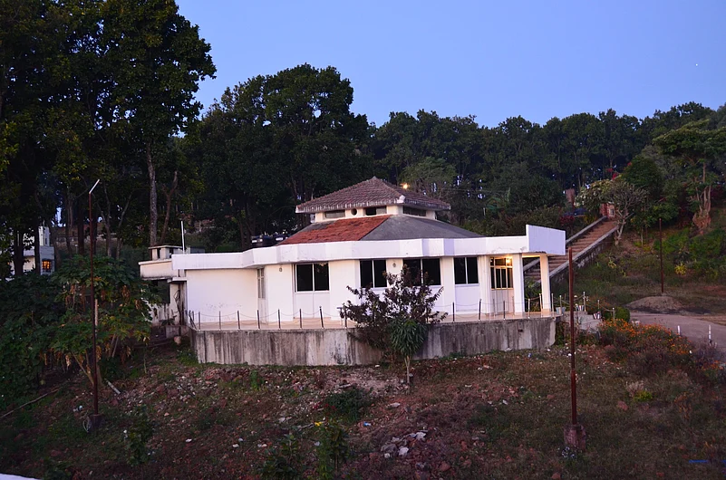
The Netarhat Vidyalaya (a residential school) is about 2km from the tourist lodge. Less than a km from the school is the Chalet House, an old British building. It was converted into a museum housing paintings and sculptures. It also contains artefacts used by tribal people like farming equipment and household items.
About 2km from the Netarhat bus stand is a dam built during the British period. Surrounded by hills, it is a popular picnic point in winter.
Magnolia Point
Probably no British hill station in India is without a scandal or a suicide point. Netarhat is no exception. According to local tales, an English resident named Magnolia fell in love with a local peasant during the colonial period. But driven to the edge by society, she committed suicide by jumping off the cliff. Since then, the place has become known as Magnolia Point. The local administration has spruced up Magnolia Point, where you can catch the best sunset view. If you start early, you may spend some time at the viewpoint from where the Koel River can be seen meandering through the verdant hills below.
Dotted With Waterfalls
The hills surrounding Netarhat are dotted with hilly springs and waterfalls. The Upper Ghagri waterfall is about 6km from Netarhat. Lower Ghagri is another 4km away from here. The area has many orchards growing pears (nashpati). To reach both waterfalls, leave the car behind and walk through the forest.
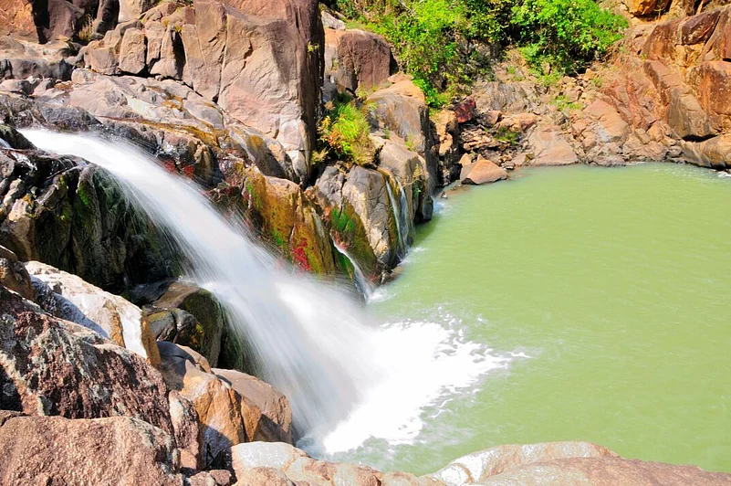
If you are looking for a longer outing, drive down to the Lodh waterfalls, the highest waterfall of Jharkhand, about 62km from Netarhat (via Mahuadanr town). It is also known as Burha Ghagh (ghagh is the local term for waterfalls). The Burha River is joined by several streams running down the hills. The waterfalls thus formed jumps down over 140 metres into a pool that disappears in the forest. It is advisable to be careful as the rocks can be slippery, and avoid going too near the base of the falls.
As darkness settles over the hills, Netarhat draws into a shell. Soon after sunset, visitors retire to their hotels, and the roads turn empty. A veil of quietness drops over the surrounding hills as nature takes rest to rise with the sun on the morrow.
Getting There
Netarhat is about 156km west of Ranchi, the nearest airport and rail station. Usually, visitors combine a visit to Netarhat with Betla National Park (about 115km away via Mahuadanr town).
Pro Tip: As it is an offbeat tourist destination, it is advisable not to stray into deserted areas even when travelling in a group. Ask for permission before taking photographs of tribal people. Woollens are required in winter. Carry mosquito/insect repellents and essential medicines.
Best Time To Visit: November to March