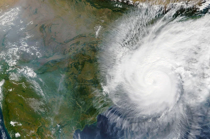
The southwest monsoon is expected to arrive in Kerala over the next four to five days, significantly earlier than the customary June 1 date, the India Meteorological Department (IMD) said on Tuesday, May 20.
The meteorological bureau had previously predicted that the monsoon will arrive over Kerala on May 27. If the monsoon comes in Kerala as projected, it will be the earliest onset on the Indian mainland since May 23, 2009, according to IMD statistics.
“Conditions are likely to become favourable for monsoon onset over Kerala during next 4-5 days,” the IMD said in an update on Tuesday afternoon.

Normally, the southwest monsoon begins over Kerala on June 1 and covers the entire country by July 8. It starts retreating from northwest India around September 17 and withdraws completely by October 15.
The IMD had earlier issued a red alert for coastal Karnataka from May 20 until 8:30 AM on May 22. Later, a yellow alert was sounded for the coastal belt until 8:30 AM on May 26. As of May 21, Mumbai has issued a four-day yellow alert, citing low to moderate rain.
At the same time, IMD has issued orange alerts for Bengaluru and Goa, in light of the torrential downpours and strong winds at both places.
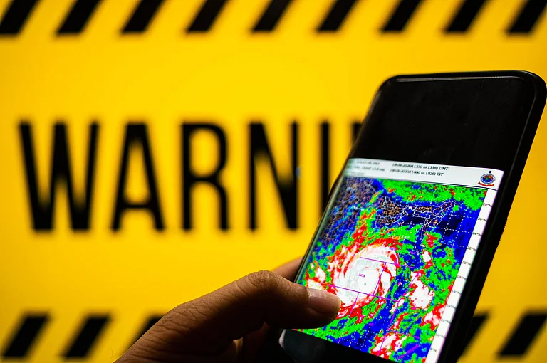
These colour-coded warning systems frequently make the rounds during the cyclone and monsoon seasons. But what do they mean?
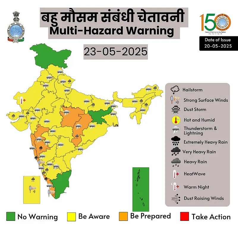
What Is The Colour-Coded Weather Alert System Used By IMD?
The monsoon season brings with it shifting weather patterns and a heightened risk of flooding and landslides. Thus, the primary function of the IMD's colour-coded weather alert system is to simplify complicated weather data into categories that are simple to comprehend. When these alerts are issued, citizens determine the degree of risk connected with upcoming weather conditions by understanding and comprehending their meaning. This aids with proper preparation, lessens the effects of bad weather and guarantees people's safety.
What Are The Colours Used And What Do They Mean?
The IMD uses four colours in its weather alert system: green, yellow, orange and red. Each shade represents a distinct degree of possible risk so that people can adjust their level of readiness accordingly.

Green Alert (No Advisory)
This alert indicates normal weather, with little or no rainfall. This frequently results in weak, sporadic rain or even dry weather during the monsoon. If this alert is ever issued, it also means there are no serious weather-related issues, and people can go outside and conduct their daily businesses normally.
Yellow Alert (Be Aware)
When this alert is issued, it means there is a chance of moderate rainfall of 64.5 mm to 115.5 mm over 24 hours. This alert signifies that rainfall won't be particularly heavy, and that the amount of rain can cause isolated flooding in low-lying regions and interfere with outdoor preparations. When travelling through possibly impacted areas, residents should exercise caution, keep an eye out and bring umbrellas.

Orange Alert (Be Prepared)
An orange alert is issued when heavy rainfall is anticipated, typically exceeding 115.6 mm and up to 204.4 mm within 24 hours. This alert indicates a heightened risk of flooding in streets, streams and vulnerable zones. Citizens should stay indoors if possible, stock up on essential supplies, and prepare for possible transportation disruptions, power outages and landslides.
Red Alert (Take Action)
The red alert represents the most severe weather warnings, indicating extremely heavy rainfall over 204.5 mm within 24 hours. This alert poses significant threats to life and property, with the potential for widespread flooding, disruption of essential services and the likelihood of evacuation orders. During a red alert, prioritising safety is paramount; individuals should avoid travel and follow local authorities' instructions.
How Is The Colour Forecast Decided?
The IMD follows a specific matrix based on the probability of occurrence of a particular weather event and its impact assessment over a five-day forecast period.
This includes factors like meteorological, hydrological and geophysical conditions, etc., which may interact to determine the impact and risk. Thus, the weather office takes into account all these factors to decide the appropriate colour code for a warning.
(With inputs from multiple reports)